|
search place name
|
||
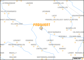
Froidvent (Bourgogne, France)Froidvent is a town in the Bourgogne region of France. An overview map of the region around Froidvent is displayed below.
regional and 3d topo map of Froidvent, France ::
Froidvent airports ::
The nearest airport is DIJ - Dijon Longvic, located 62.5 km south of Froidvent.
Other airports nearby include QYR - Troyes Barberey (83.2 km north west), DLE - Dole Tavaux (96.3 km south east), AUF - Auxerre Branches (99.0 km west), XCD - Chalon Champforgeuil (108.3 km south), Nearby towns ::
Leuglay (2.2km north west) //
Voulaines (3.1km north west) //
Recey-sur-Ource (4.2km south east) //
La Forêt (6.1km south east) //
Faverolles-lès-Lucey (5.3km north east) //
La Chaume (7.5km north) //
Montmoyen (7.5km south) //
Essarois (6.7km south west) //
Lucey (6.7km north east) //
Hierce (7.8km south) //
Terrefondrée (8.3km south east) //
[all distances 'as the bird flies' and approximate] 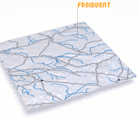
Disclaimer :: Information on this page comes without warranty of any kind |
||
|
Where is Froidvent? Elevation and coordinates ::
Latitude (lat): 47°48'0"N Longitude (lon): 4°49'0"E
Elevation (approx.): 310m (map arrows pan, magnifying glasses zoom) |
||
|
Visiting Froidvent? Hotel/Accommodation ::
Book a hotel in Froidvent Travel Guide ::
Buy a travel guide for France rental cars ::
car rental offers GPS waypoint ::
download a GPX waypoint (PoI) of Froidvent for your GPS receiver
|
||