|
search place name
|
||
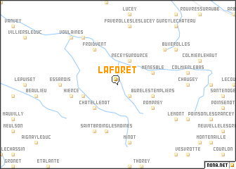
La Forêt (Bourgogne, France)La Forêt is a town in the Bourgogne region of France. An overview map of the region around La Forêt is displayed below.
regional and 3d topo map of La Forêt, France ::
La Forêt airports ::
The nearest airport is DIJ - Dijon Longvic, located 56.5 km south of La Forêt.
Other airports nearby include QYR - Troyes Barberey (88.9 km north west), DLE - Dole Tavaux (90.3 km south east), AUF - Auxerre Branches (102.0 km west), XCD - Chalon Champforgeuil (102.7 km south), Nearby towns ::
Terrefondrée (2.2km south east) //
Recey-sur-Ource (3.9km north) //
Châtellenot (4.5km south west) //
Montmoyen (4.2km south west) //
Bure-les-Templiers (4.2km south east) //
Menesble (4.2km north east) //
Froidvent (6.1km north west) //
Romprey (5.3km south east) //
Saint-Broing-les-Moines (7.5km south) //
Hierce (5.3km west) //
Moitron (7.8km south) //
Chambain (7.5km north east) //
Leuglay (8.3km north west) //
Voulaines (8.9km north west) //
[all distances 'as the bird flies' and approximate]  Places with similar names to La Forêt, France ::
Disclaimer :: Information on this page comes without warranty of any kind |
||
|
Where is La Forêt? Elevation and coordinates ::
Latitude (lat): 47°45'0"N Longitude (lon): 4°51'0"E
Elevation (approx.): 352m (map arrows pan, magnifying glasses zoom) |
||
|
Visiting La Forêt? Hotel/Accommodation ::
Book a hotel in La Forêt Travel Guide ::
Buy a travel guide for France rental cars ::
car rental offers GPS waypoint ::
download a GPX waypoint (PoI) of La Forêt for your GPS receiver
|
||