|
search place name
|
||
Jumet (Midi-Pyrénées, France)Jumet is a town in the Midi-Pyrénées region of France. An overview map of the region around Jumet is displayed below.
regional and 3d topo map of Jumet, France ::

Jumet airports ::
The nearest airport is LDE - Tarbes Lourdes, located 39.6 km north west of Jumet.
Other airports nearby include PUF - Pau Pyrenees (79.8 km north west), LRH - La Rochelle Lherm (91.6 km north east), LEU - Seo De Urgel (109.2 km south east), TLS - Toulouse Blagnac (110.6 km north east), Nearby towns ::
Beyrède-Jumet (1.4km east) //
Camous (1.4km east) //
Fréchet-Aure (1.9km south) //
Sarrancolin (2.3km north east) //
Ilhet (2.3km north east) //
Aspin-Aure (2.3km south west) //
Pailhac (3.7km south) //
Ardengost (3.3km south east) //
Barrancoueu (4.6km south west) //
Rebouc (5.6km north) //
Arreau (5.6km south) //
Jézeau (5.7km south) //
Cadéac (5.7km south) //
Hèches (7.4km north) //
Lançon (7.4km south) //
Cazaux-Debat (7.5km south) //
Grézian (7.5km south) //
Bordères-Louron (7.9km south) //
Ris (7.9km south) //
Ancizan (7.9km south) //
Bareilles (7.8km south east) //
[all distances 'as the bird flies' and approximate] 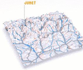 Places with similar names to Jumet, France ::
Disclaimer :: Information on this page comes without warranty of any kind |
||
|
Where is Jumet? Elevation and coordinates ::
Latitude (lat): 42°57'0"N Longitude (lon): 0°22'0"W
Elevation (approx.): 1007m (map arrows pan, magnifying glasses zoom) |
||
|
Visiting Jumet? Hotel/Accommodation ::
Book a hotel in Jumet Travel Guide ::
Buy a travel guide for France rental cars ::
car rental offers GPS waypoint ::
download a GPX waypoint (PoI) of Jumet for your GPS receiver
|
||