|
search place name
|
||
Kerhuel (Bretagne, France)Kerhuel is a town in the Bretagne region of France. An overview map of the region around Kerhuel is displayed below.
regional and 3d topo map of Kerhuel, France ::

Kerhuel airports ::
The nearest airport is UIP - Quimper Pluguffan, located 12.2 km west of Kerhuel.
Other airports nearby include LRT - Lorient Lann Bihoue (51.7 km south east), BES - Brest Guipavas (56.5 km north west), MXN - Morlaix Ploujean (66.9 km north), LAI - Lannion (91.4 km north east), Nearby towns ::
Penanerch (1.2km west) //
Quellenec (1.2km west) //
Ergué-Gabéric (2.2km south west) //
Keranhier (5.7km north) //
Kerancloarec (4.2km north west) //
Kerdevot (4.2km south east) //
Cuzon (4.2km south west) //
Landudal (6.1km north east) //
Ergué-Armel (5.3km south west) //
Kerlinic (5.3km east) //
Landrévarzec (7.8km north) //
Coat-Dréga (7.8km north) //
Trévidec (6.2km north east) //
Bas Botbodern (6.2km south east) //
Haut Botbodern (6.2km south east) //
Quilinen (8.3km north west) //
Kerdelliou (8.9km north east) //
[all distances 'as the bird flies' and approximate] 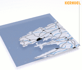 Places with similar names to Kerhuel, France ::
// Quarry Hill (BZ)
// Gray Hill (US)
// Curry Hill (US)
// Gray Hill (US)
// Kruhel (PL)
// Karahallı (TR)
// Kauru Hill (NZ)
// Kerr Hill (US)
// Corey Hill (US)
// Curry Hill (US)
Disclaimer :: Information on this page comes without warranty of any kind |
||
|
Where is Kerhuel? Elevation and coordinates ::
Latitude (lat): 48°1'0"N Longitude (lon): 4°1'0"W
Elevation (approx.): 113m (map arrows pan, magnifying glasses zoom) |
||
|
Visiting Kerhuel? Hotel/Accommodation ::
Book a hotel in Kerhuel Travel Guide ::
Buy a travel guide for France rental cars ::
car rental offers GPS waypoint ::
download a GPX waypoint (PoI) of Kerhuel for your GPS receiver
|
||