|
search place name
|
||
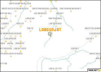
La Bourjat (Rhône-Alpes, France)La Bourjat is a town in the Rhône-Alpes region of France. An overview map of the region around La Bourjat is displayed below.
regional and 3d topo map of La Bourjat, France ::
La Bourjat airports ::
The nearest airport is CMF - Chambery Aix Les Bains, located 42.0 km north of La Bourjat.
Other airports nearby include GNB - Grenoble Saint Geoirs (58.5 km west), NCY - Annecy Meythet (71.8 km north), LYS - Lyon Saint Exupery (90.8 km north west), VAF - Valence Chabeuil (95.2 km south west), Nearby towns ::
Fond de France (0.0km north) //
La Ferrière (3.9km north) //
Montarmand (5.7km north) //
Theys (5.5km west) //
Pinsot (7.9km north) //
Le Charpieu (7.9km north) //
La Ruche (7.6km north west) //
[all distances 'as the bird flies' and approximate]  Places with similar names to La Bourjat, France ::
// Laberget (NO)
// Laberget (NO)
// La Brigida (CU)
// Liborajdea (RO)
// Le Bourget (FR)
// Loberget (SE)
// Lyberget (SE)
// La Brígida (DO)
// La Bourgeade (FR)
// Labrejade (FR)
Disclaimer :: Information on this page comes without warranty of any kind |
||
|
Where is La Bourjat? Elevation and coordinates ::
Latitude (lat): 45°17'0"N Longitude (lon): 6°4'0"E
Elevation (approx.): 1302m (map arrows pan, magnifying glasses zoom) |
||
|
Visiting La Bourjat? Hotel/Accommodation ::
Book a hotel in La Bourjat Travel Guide ::
Buy a travel guide for France rental cars ::
car rental offers GPS waypoint ::
download a GPX waypoint (PoI) of La Bourjat for your GPS receiver
|
||