|
search place name
|
||
La Hoguette (Basse-Normandie, France)La Hoguette is a town in the Basse-Normandie region of France. An overview map of the region around La Hoguette is displayed below.
regional and 3d topo map of La Hoguette, France ::

La Hoguette airports ::
The nearest airport is CFR - Caen Carpiquet, located 38.3 km north west of La Hoguette.
Other airports nearby include DOL - Deauville St Gatien (58.5 km north east), LEH - Le Havre Octeville (74.7 km north), LVA - Laval Entrammes (103.9 km south west), LME - Le Mans Arnage (107.5 km south), Nearby towns ::
Éraines (1.9km north) //
Falaise (3.1km north west) //
Versainville (3.9km north) //
Villy-lès-Falaise (3.1km north east) //
Saint-Pierre-du-Bû (4.1km south west) //
Pertheville-Ners (4.1km south east) //
Fresné-la-Mère (4.1km north east) //
Aubigny (5.2km north west) //
Damblainville (5.2km north east) //
Épaney (7.4km north) //
Saint-Martin-de-Mieux (5.2km west) //
Nécy (6.7km south east) //
Saint-Pierre-Canivet (6.7km north west) //
Cordey (6.1km south west) //
Neuvy-au-Houlme (7.8km south) //
Rônai (7.8km south) //
Vignats (6.1km south east) //
Soulangy (8.3km north west) //
Bazoches-au-Houlme (8.9km south west) //
[all distances 'as the bird flies' and approximate] 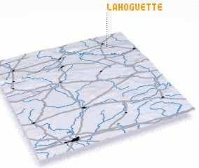 Places with similar names to La Hoguette, France ::
// Lahikot (IN)
// Luhāgudi (IN)
// Léhaguid (MR)
// La Hicotea (VE)
// La Hicotea (VE)
// La Hicotea (DO)
// La Hicotea (DO)
// La Hicotea (DO)
// Le Hoquet (FR)
Disclaimer :: Information on this page comes without warranty of any kind |
||
|
Where is La Hoguette? Elevation and coordinates ::
Latitude (lat): 48°53'0"N Longitude (lon): 0°10'0"W
Elevation (approx.): 121m (map arrows pan, magnifying glasses zoom) |
||
|
Visiting La Hoguette? Hotel/Accommodation ::
Book a hotel in La Hoguette Travel Guide ::
Buy a travel guide for France rental cars ::
car rental offers GPS waypoint ::
download a GPX waypoint (PoI) of La Hoguette for your GPS receiver
|
||