|
search place name
|
||
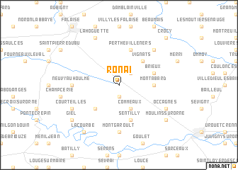
Rônai (Basse-Normandie, France)Rônai is a town in the Basse-Normandie region of France. An overview map of the region around Rônai is displayed below.
regional and 3d topo map of Rônai, France ::
Rônai airports ::
The nearest airport is CFR - Caen Carpiquet, located 45.9 km north west of Rônai.
Other airports nearby include DOL - Deauville St Gatien (64.5 km north), LEH - Le Havre Octeville (81.4 km north), LVA - Laval Entrammes (98.3 km south west), LME - Le Mans Arnage (99.7 km south), Nearby towns ::
Ri (1.9km south) //
Nécy (2.2km north east) //
Commeaux (3.9km south) //
Vignats (4.4km north east) //
Habloville (4.4km south west) //
Montabard (3.7km east) //
Sentilly (5.7km south) //
Brieux (4.1km north east) //
Pertheville-Ners (5.7km north) //
Montgaroult (7.4km south) //
Neuvy-au-Houlme (4.9km west) //
Fourches (6.7km north east) //
La Hoguette (7.8km north) //
Occagnes (6.1km south east) //
Courteilles (6.1km south west) //
Moulins-sur-Orne (7.4km south east) //
Giel (7.4km south west) //
La Courbe (8.3km south west) //
Crocy (8.9km north east) //
[all distances 'as the bird flies' and approximate] 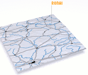 Places with similar names to Rônai, France ::
Disclaimer :: Information on this page comes without warranty of any kind |
||
|
Where is Rônai? Elevation and coordinates ::
Latitude (lat): 48°49'0"N Longitude (lon): 0°8'0"W
Elevation (approx.): 246m (map arrows pan, magnifying glasses zoom) |
||
|
Visiting Rônai? Hotel/Accommodation ::
Book a hotel in Rônai Travel Guide ::
Buy a travel guide for France rental cars ::
car rental offers GPS waypoint ::
download a GPX waypoint (PoI) of Rônai for your GPS receiver
|
||