|
search place name
|
||
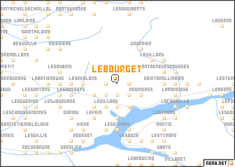
Le Bourget (Provence-Alpes-Côte dʼAzur, France)Le Bourget is a town in the Provence-Alpes-Côte dʼAzur region of France. An overview map of the region around Le Bourget is displayed below.
regional and 3d topo map of Le Bourget, France ::
Le Bourget airports ::
The nearest airport is CUF - Levaldigi, located 105.2 km east of Le Bourget.
Other airports nearby include VAF - Valence Chabeuil (112.5 km west), GNB - Grenoble Saint Geoirs (117.0 km north west), CMF - Chambery Aix Les Bains (123.6 km north), NCE - Nice Cote D Azur (124.7 km south east), Nearby towns ::
Pomeiret (1.3km east) //
Les Bonjours (1.3km west) //
Les Lagiers (1.9km south) //
Les Gourres (2.3km south east) //
Les Augiers (2.3km south east) //
Chorges (2.3km south west) //
Le Saint-Sépulcre (3.7km south) //
Le Martouret (3.2km south west) //
Prunières (3.2km south east) //
Le Villard (3.9km south) //
Les Bernards (3.9km south) //
Les Chaussins (4.6km south west) //
Les Olliviers (4.6km south west) //
Chanteloube (5.6km south) //
Les Réalons (4.0km west) //
Les Espagnes (4.0km west) //
Le Fein (6.2km south west) //
Le Villard (5.4km north east) //
Gournier (6.2km north east) //
Les Hyvans (7.4km south) //
Les Brès (5.3km west) //
Saint-Apollinaire (5.3km east) //
Montagne des Rousses (5.6km east) //
Les Glaisoles (7.5km south) //
Grand Pré (7.5km south) //
Les Massots (5.6km west) //
Montgardin (5.6km west) //
Réallon (6.5km north east) //
Les Chappas (7.7km south east) //
[all distances 'as the bird flies' and approximate]  Places with similar names to Le Bourget, France ::
// Laberget (NO)
// Laberget (NO)
// La Brigida (CU)
// Liborajdea (RO)
// Le Bourget (FR)
// Loberget (SE)
// Lyberget (SE)
// La Brígida (DO)
// La Bourgeade (FR)
// La Bourjat (FR)
Disclaimer :: Information on this page comes without warranty of any kind |
||
|
Where is Le Bourget? Elevation and coordinates ::
Latitude (lat): 44°34'0"N Longitude (lon): 6°18'0"E
Elevation (approx.): 1360m (map arrows pan, magnifying glasses zoom) |
||
|
Visiting Le Bourget? Hotel/Accommodation ::
Book a hotel in Le Bourget Travel Guide ::
Buy a travel guide for France rental cars ::
car rental offers GPS waypoint ::
download a GPX waypoint (PoI) of Le Bourget for your GPS receiver
|
||