|
search place name
|
||
Le Chênai (Basse-Normandie, France)Le Chênai is a town in the Basse-Normandie region of France. An overview map of the region around Le Chênai is displayed below.
regional and 3d topo map of Le Chênai, France ::

Le Chênai airports ::
The nearest airport is LME - Le Mans Arnage, located 75.8 km south west of Le Chênai.
Other airports nearby include ORE - Orleans Bricy (94.4 km south east), URO - Rouen Vallee De Seine (101.0 km north), TNF - Toussous-le-noble Toussus Le Noble (102.1 km east), DOL - Deauville St Gatien (104.5 km north west), Nearby towns ::
Le Val du Tellier (2.2km north east) //
Longny-au-Perche (2.2km north west) //
Bizou (2.2km south west) //
La Porte (2.5km west) //
Le Mage (3.1km south east) //
Le Pont Riboult (3.1km south east) //
Les Loges des Gars (4.4km north east) //
La Véronnière (5.6km north) //
Moulicent (5.6km north) //
La Douvellerie (3.7km east) //
La Chauvellière (3.7km west) //
La Patrie (5.2km north west) //
Les Épasses (6.1km north west) //
LʼHôtel Provôt (5.2km south east) //
Foucaudière (6.1km south west) //
La Bonnière (4.9km west) //
La Charmoie (5.2km west) //
Saint-Victor-de-Réno (5.2km west) //
La Halerie (5.2km west) //
Le Bois Boulai (6.2km north west) //
La Roberie (6.2km south west) //
Monceaux (6.2km south west) //
Marchainville (8.3km north east) //
LʼHôme-Chamondot (8.3km north west) //
Malétable (7.4km north west) //
Freulemont (8.3km south east) //
Chêne (7.4km south west) //
La Chalarderie (8.9km north east) //
Saint-Maurice-sur-Huisne (8.9km south west) //
[all distances 'as the bird flies' and approximate] 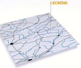 Places with similar names to Le Chênai, France ::
Disclaimer :: Information on this page comes without warranty of any kind |
||
|
Where is Le Chênai? Elevation and coordinates ::
Latitude (lat): 48°31'0"N Longitude (lon): 0°46'0"W
Elevation (approx.): 226m (map arrows pan, magnifying glasses zoom) |
||
|
Visiting Le Chênai? Hotel/Accommodation ::
Book a hotel in Le Chênai Travel Guide ::
Buy a travel guide for France rental cars ::
car rental offers GPS waypoint ::
download a GPX waypoint (PoI) of Le Chênai for your GPS receiver
|
||