|
search place name
|
||
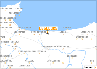
Les Cours (Bretagne, France)Les Cours is a town in the Bretagne region of France. An overview map of the region around Les Cours is displayed below.
regional and 3d topo map of Les Cours, France ::
Les Cours airports ::
The nearest airport is DNR - Dinard Pleurtuit, located 24.4 km west of Les Cours.
Other airports nearby include RNS - Rennes St Jacques (59.0 km south), JER - Jersey (75.1 km north west), SBK - St.-brieuc Armor Armor (81.8 km west), LVA - Laval Entrammes (97.9 km south east), Nearby towns ::
Le Vivier-sur-Mer (2.5km west) //
Hirel (3.7km west) //
Cherrueix (3.7km east) //
Le Han (3.7km east) //
Dol-de-Bretagne (5.6km south) //
La Butte (5.2km east) //
Baguer-Pican (6.7km south east) //
Baguer-Morvan (7.8km south) //
[all distances 'as the bird flies' and approximate]  Places with similar names to Les Cours, France ::
// Los Chorros (PA)
// Łaskarzew (PL)
// Lisikierz (PL)
// Los Güiros (CU)
// Los Güiros (CU)
// Lascorz (ES)
// Los Curas (ES)
// Los Currás (ES)
// Los Curros (ES)
// Los Garres (ES)
Disclaimer :: Information on this page comes without warranty of any kind |
||
|
Where is Les Cours? Elevation and coordinates ::
Latitude (lat): 48°36'0"N Longitude (lon): 1°45'0"W
Elevation (approx.): 4m (map arrows pan, magnifying glasses zoom) |
||
|
Visiting Les Cours? Hotel/Accommodation ::
Book a hotel in Les Cours Travel Guide ::
Buy a travel guide for France rental cars ::
car rental offers GPS waypoint ::
download a GPX waypoint (PoI) of Les Cours for your GPS receiver
|
||