|
search place name
|
||
Les Tuileries (Bourgogne, France)Les Tuileries is a town in the Bourgogne region of France. An overview map of the region around Les Tuileries is displayed below.
regional and 3d topo map of Les Tuileries, France ::

Les Tuileries airports ::
The nearest airport is AUF - Auxerre Branches, located 27.9 km south east of Les Tuileries.
Other airports nearby include QYR - Troyes Barberey (74.6 km north east), ORY - Paris Orly (103.4 km north west), ORE - Orleans Bricy (105.0 km west), NVS - Nevers Fourchambault (107.3 km south), Nearby towns ::
LʼArchangerie (0.0km north) //
Arblay (1.2km west) //
Cudot (2.2km north east) //
Les Vieux Écharlis (2.2km south east) //
Les Halliers (4.5km north west) //
Villefranche-Saint-Phal (4.5km south west) //
Saint-Loup-dʼOrdon (5.6km north) //
Le Grand Marchais (5.7km south) //
Chevillon (5.7km south) //
Saint-Martin-dʼOrdon (5.7km north) //
Les Croutheaux (4.2km south west) //
Les Gauguins (5.3km north east) //
Prunoy (6.1km south west) //
Malvrain (7.4km south) //
Les Panats (5.0km west) //
Sépeaux (5.3km east) //
Les Richards (7.5km south) //
Les Martins (6.2km north east) //
Les Favéreaux (7.8km north) //
Saint-Romain-le-Preux (6.2km south east) //
Les Garniers (7.8km north) //
Les Grands Guillaumes (6.2km north west) //
Les Petits Guillaumes (6.2km north west) //
Les Guillaumes (6.2km north west) //
Dicy (6.2km south west) //
Verlin (7.5km north east) //
Les Jubliers (7.5km south west) //
Les Marinières (8.9km north east) //
La Ferté-Loupière (8.9km south east) //
[all distances 'as the bird flies' and approximate] 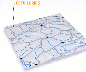 Places with similar names to Les Tuileries, France ::
// Las Dolores (CU)
// Los Dolores (CU)
// Los Dolores (ES)
// Los Dolores (ES)
// Los Dolores (GT)
// Los Dolores (MX)
// Los Dolores (MX)
// Los Dolores (MX)
// Los Dolores (MX)
// Los Dolores (MX)
Disclaimer :: Information on this page comes without warranty of any kind |
||
|
Where is Les Tuileries? Elevation and coordinates ::
Latitude (lat): 47°58'0"N Longitude (lon): 3°10'0"E
Elevation (approx.): 210m (map arrows pan, magnifying glasses zoom) |
||
|
Visiting Les Tuileries? Hotel/Accommodation ::
Book a hotel in Les Tuileries Travel Guide ::
Buy a travel guide for France rental cars ::
car rental offers GPS waypoint ::
download a GPX waypoint (PoI) of Les Tuileries for your GPS receiver
|
||