|
search place name
|
||
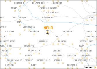
Meun (Île-de-France, France)Meun is a town in the Île-de-France region of France. An overview map of the region around Meun is displayed below.
regional and 3d topo map of Meun, France ::
Meun airports ::
The nearest airport is ORY - Paris Orly, located 44.4 km north of Meun.
Other airports nearby include TNF - Toussous-le-noble Toussus Le Noble (56.2 km north west), LBG - Paris Le Bourget (69.5 km north), ORE - Orleans Bricy (72.2 km south west), CDG - Paris Charles De Gaulle (73.7 km north), Nearby towns ::
Achères-la-Forêt (0.0km north) //
La Chapelle-la-Reine (3.9km south) //
Ury (3.1km south east) //
Butteaux (3.9km south) //
Bessonville (4.5km south east) //
Corne-Biche (5.6km north) //
Le Vaudoué (3.7km west) //
Busseau (5.2km south east) //
Recloses (4.9km east) //
Arbonne (7.4km north) //
Melun-Sénart (7.5km north) //
Noisy-sur-École (5.3km west) //
Le Carrouge (5.3km west) //
Larchant (7.8km south) //
Boissy-aux-Cailles (6.2km south west) //
Amponville (7.8km south) //
Jacqueville (8.3km south west) //
Marlanval (7.4km south west) //
[all distances 'as the bird flies' and approximate] 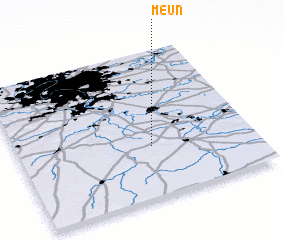 Places with similar names to Meun, France ::
Disclaimer :: Information on this page comes without warranty of any kind |
||
|
Where is Meun? Elevation and coordinates ::
Latitude (lat): 48°21'0"N Longitude (lon): 2°34'0"E
Elevation (approx.): 115m (map arrows pan, magnifying glasses zoom) |
||
|
Visiting Meun? Hotel/Accommodation ::
Book a hotel in Meun Travel Guide ::
Buy a travel guide for France rental cars ::
car rental offers GPS waypoint ::
download a GPX waypoint (PoI) of Meun for your GPS receiver
|
||