|
search place name
|
||
Rocquigny (Nord-Pas-de-Calais, France)Rocquigny is a town in the Nord-Pas-de-Calais region of France. An overview map of the region around Rocquigny is displayed below.
regional and 3d topo map of Rocquigny, France ::

Rocquigny airports ::
The nearest airport is LIL - Lille Lesquin, located 58.3 km north of Rocquigny.
Other airports nearby include QKT - Kortrijk-vevelgem Wevelgem (87.8 km north), BVA - Beauvais Tille (88.0 km south west), CSF - Creil (93.1 km south), LTQ - Le Tourquet Le Touquet Paris Plage (106.0 km north west), Nearby towns ::
Sailly-Saillisel (1.9km south) //
Barastre (2.2km north east) //
Villers-au-Flos (3.7km north) //
Le Transloy (2.4km west) //
Haplincourt (3.9km north) //
Mesnil-en-Arrouaise (3.0km south east) //
Riencourt-lès-Bapaume (4.4km north west) //
Rancourt (5.6km south) //
Bus (3.6km east) //
Lesboeufs (4.0km south west) //
Morval (4.0km south west) //
Béaulencourt (4.0km north west) //
Combles (5.1km south west) //
Manancourt (5.1km south east) //
Bancourt (6.0km north west) //
Léchelle (4.8km east) //
Bouchavesnes-Bergen (7.4km south) //
Étricourt-Manancourt (5.1km east) //
Beugny (7.5km north) //
Frémicourt (7.5km north) //
Vélu (6.6km north east) //
Bertincourt (6.0km north east) //
Beugnâtre (7.8km north) //
Moislains (8.2km south east) //
Bapaume (7.3km north west) //
Lebucquière (8.2km north east) //
Beaumetz-lès-Cambrai (8.8km north east) //
Favreuil (8.8km north west) //
[all distances 'as the bird flies' and approximate] 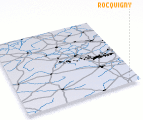
Disclaimer :: Information on this page comes without warranty of any kind |
||
|
Where is Rocquigny? Elevation and coordinates ::
Latitude (lat): 50°3'0"N Longitude (lon): 2°55'0"E
Elevation (approx.): 133m (map arrows pan, magnifying glasses zoom) |
||
|
Visiting Rocquigny? Hotel/Accommodation ::
Book a hotel in Rocquigny Travel Guide ::
Buy a travel guide for France rental cars ::
car rental offers GPS waypoint ::
download a GPX waypoint (PoI) of Rocquigny for your GPS receiver
|
||