|
search place name
|
||
Rancourt (Picardie, France)Rancourt is a town in the Picardie region of France. An overview map of the region around Rancourt is displayed below.
regional and 3d topo map of Rancourt, France ::

Rancourt airports ::
The nearest airport is LIL - Lille Lesquin, located 63.7 km north of Rancourt.
Other airports nearby include BVA - Beauvais Tille (83.9 km south west), CSF - Creil (87.8 km south), QKT - Kortrijk-vevelgem Wevelgem (93.2 km north), LTQ - Le Tourquet Le Touquet Paris Plage (108.9 km north west), Nearby towns ::
Bouchavesnes-Bergen (1.9km south) //
Sailly-Saillisel (3.7km north) //
Mesnil-en-Arrouaise (4.4km north east) //
Rocquigny (5.6km north) //
Combles (4.0km north west) //
Moislains (4.0km south east) //
Manancourt (4.0km north east) //
Allaines (6.0km south east) //
Lesboeufs (5.1km north west) //
Morval (5.1km north west) //
Cléry-sur-Somme (6.0km south west) //
Le Transloy (6.0km north west) //
Sainte-Radegonde (7.4km south) //
Barastre (7.5km north) //
Péronne (7.5km south) //
Mont-Saint-Quentin (7.5km south) //
Bus (6.6km north east) //
Étricourt-Manancourt (6.0km north east) //
Aizecourt-le-Haut (7.3km south east) //
Léchelle (7.3km north east) //
Feuillères (7.3km south west) //
Béaulencourt (8.2km north west) //
Bussu (8.2km south east) //
[all distances 'as the bird flies' and approximate] 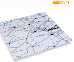 Places with similar names to Rancourt, France ::
// Rinkerode (DE)
// Ríonegrito (ES)
// Raincourt (FR)
// Renaucourt (FR)
// Riencourt (FR)
// Roncourt (FR)
// Rancourt (FR)
// Rengård (SE)
// Rainecourt (FR)
// Roncourt (FR)
Disclaimer :: Information on this page comes without warranty of any kind |
||
|
Where is Rancourt? Elevation and coordinates ::
Latitude (lat): 50°0'0"N Longitude (lon): 2°55'0"E
Elevation (approx.): 134m (map arrows pan, magnifying glasses zoom) |
||
|
Visiting Rancourt? Hotel/Accommodation ::
Book a hotel in Rancourt Travel Guide ::
Buy a travel guide for France rental cars ::
car rental offers GPS waypoint ::
download a GPX waypoint (PoI) of Rancourt for your GPS receiver
|
||