|
search place name
|
||
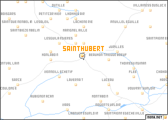
Saint-Hubert (Pays de la Loire, France)Saint-Hubert is a town in the Pays de la Loire region of France. An overview map of the region around Saint-Hubert is displayed below.
regional and 3d topo map of Saint-Hubert, France ::
Saint-Hubert airports ::
The nearest airport is LME - Le Mans Arnage, located 23.1 km north west of Saint-Hubert.
Other airports nearby include TUF - Tours Val De Loire (46.8 km south east), LVA - Laval Entrammes (86.9 km west), ORE - Orleans Bricy (108.3 km east), CET - Cholet Le Pontreau (119.8 km south west), Nearby towns ::
Haute Perche (1.9km north) //
Le Plessis (3.7km north) //
Laillé (3.9km north) //
Beaumont-Pied-de-Boeuf (3.7km east) //
Marigné-Laillé (5.7km north) //
Lavernat (5.7km south) //
Les Guilardières (5.3km north west) //
Verneil-le-Chétif (5.3km south west) //
La Chenerie (7.4km north) //
Monlabon (5.0km west) //
Mayet (5.0km west) //
La Bougardière (5.3km west) //
Jupilles (5.3km east) //
Luceau (6.7km south east) //
Château-du-Loir (8.9km south east) //
[all distances 'as the bird flies' and approximate] 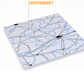 Places with similar names to Saint-Hubert, France ::
// Saint-Hubert (FR)
// Sint Hubert (NL)
// Saint-Hubert (CA)
// Saint-Hubert (FR)
// Saint-Hubert (BE)
Disclaimer :: Information on this page comes without warranty of any kind |
||
|
Where is Saint-Hubert? Elevation and coordinates ::
Latitude (lat): 47°46'0"N Longitude (lon): 0°21'0"W
Elevation (approx.): 168m (map arrows pan, magnifying glasses zoom) |
||
|
Visiting Saint-Hubert? Hotel/Accommodation ::
Book a hotel in Saint-Hubert Travel Guide ::
Buy a travel guide for France rental cars ::
car rental offers GPS waypoint ::
download a GPX waypoint (PoI) of Saint-Hubert for your GPS receiver
|
||