|
search place name
|
||
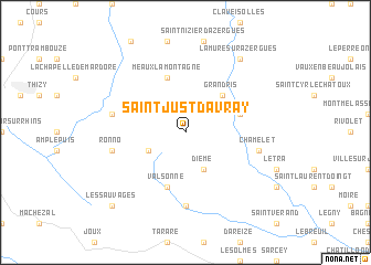
Saint-Just-dʼAvray (Rhône-Alpes, France)Saint-Just-dʼAvray is a town in the Rhône-Alpes region of France. An overview map of the region around Saint-Just-dʼAvray is displayed below.
regional and 3d topo map of Saint-Just-dʼAvray, France ::
Saint-Just-dʼAvray airports ::
The nearest airport is XVF - Vilefrance Tarare, located 18.0 km south east of Saint-Just-dʼAvray.
Other airports nearby include RNE - Roanne Renaison (35.3 km west), QNX - Macon Charnay (42.3 km north east), LYN - Lyon Bron (48.9 km south east), EBU - St.-etienne Boutheon (52.4 km south), Nearby towns ::
Saint-Appolinaire (3.2km south west) //
Dième (3.9km south) //
Grandris (4.5km north east) //
Meaux-la-Montagne (5.7km north) //
Valsonne (5.7km south) //
Chambost-Allières (4.3km north east) //
Saint-Clément-sur-Valsonne (7.4km south) //
Ronno (5.5km west) //
Cublize (5.5km west) //
Chamelet (5.5km east) //
Lamure-sur-Azergues (8.4km north east) //
Les Sauvages (9.0km south west) //
[all distances 'as the bird flies' and approximate] 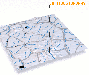 Places with similar names to Saint-Just-dʼAvray, France :: Disclaimer :: Information on this page comes without warranty of any kind |
||
|
Where is Saint-Just-dʼAvray? Elevation and coordinates ::
Latitude (lat): 46°0'0"N Longitude (lon): 4°27'0"E
Elevation (approx.): 492m (map arrows pan, magnifying glasses zoom) |
||
|
Visiting Saint-Just-dʼAvray? Hotel/Accommodation ::
Book a hotel in Saint-Just-dʼAvray Travel Guide ::
Buy a travel guide for France rental cars ::
car rental offers GPS waypoint ::
download a GPX waypoint (PoI) of Saint-Just-dʼAvray for your GPS receiver
|
||