|
search place name
|
||
Saint-Saire (Haute-Normandie, France)Saint-Saire is a town in the Haute-Normandie region of France. An overview map of the region around Saint-Saire is displayed below.
regional and 3d topo map of Saint-Saire, France ::

Saint-Saire airports ::
The nearest airport is URO - Rouen Vallee De Seine, located 42.3 km south west of Saint-Saire.
Other airports nearby include BVA - Beauvais Tille (52.1 km south east), POX - Pontoise Cormeilles En Vexin (77.7 km south east), CSF - Creil (89.0 km south east), LTQ - Le Tourquet Le Touquet Paris Plage (91.3 km north), Nearby towns ::
Nesle-Hodeng (0.0km north) //
Bouelles (1.9km north) //
Bellaunay (1.2km east) //
La Montagne (2.2km north east) //
Le Guide (2.2km south west) //
Hodeng (2.2km south east) //
La Huchonne (2.2km south west) //
Les Hommets (3.7km south) //
Les Hallais (3.9km north) //
Neuville-Ferrières (3.0km north west) //
Mare aux Daims (3.0km north east) //
Dambec (3.0km south west) //
Mesnil-Mauger (3.9km south) //
La Rosière (3.9km south) //
La Corbière (3.6km east) //
La Broche (5.7km north) //
Neufchâtel-en-Bray (5.2km north west) //
Graval (5.2km north east) //
Louvicamp (5.2km south east) //
Beaubec-la-Rosière (6.1km south east) //
Ménonval (7.4km north) //
Les Trois Oreilles (4.8km west) //
Sausseuzemare (5.1km east) //
Bois-Hatrel (5.1km west) //
Portmort (5.1km east) //
Saint-Germain-sur-Eaulne (7.5km north) //
Beaussault (5.1km east) //
Le Mesnil (7.5km south) //
Épinay (6.6km north east) //
[all distances 'as the bird flies' and approximate] 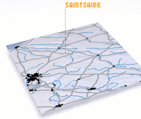 Places with similar names to Saint-Saire, France ::
// Santa Isaura (BR)
// Zintsar (RU)
// Sundisar (BD)
// Sundisār (BD)
// Santa Sara (CL)
// Saint Cyr (DM)
// Santa Sara (MX)
// Sandāsar (PK)
// Sandasarai (PK)
// Suntsar (PK)
Disclaimer :: Information on this page comes without warranty of any kind |
||
|
Where is Saint-Saire? Elevation and coordinates ::
Latitude (lat): 49°42'0"N Longitude (lon): 1°30'0"E
Elevation (approx.): 128m (map arrows pan, magnifying glasses zoom) |
||
|
Visiting Saint-Saire? Hotel/Accommodation ::
Book a hotel in Saint-Saire Travel Guide ::
Buy a travel guide for France rental cars ::
car rental offers GPS waypoint ::
download a GPX waypoint (PoI) of Saint-Saire for your GPS receiver
|
||