|
search place name
|
||
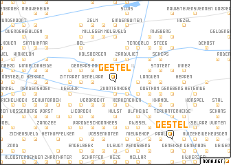
Gestel (Antwerpen, Belgium)Gestel is a town in the Antwerpen region of Belgium. An overview map of the region around Gestel is displayed below.
regional and 3d topo map of Gestel, Belgium ::
Gestel airports ::
The nearest airport is EIN - Eindhoven, located 41.2 km north east of Gestel.
Other airports nearby include ANR - Antwerp Deurne (46.6 km west), BRU - Brussels Natl (Melsbroek) (50.4 km south west), MST - Maastricht (51.2 km south east), LGG - Liege (58.1 km south east), Nearby towns ::
Zwartenhoek (1.9km south) //
Gervoort (2.2km north east) //
Gerheide (2.2km north east) //
Straal (2.2km north east) //
Rooiaarde (2.2km north west) //
Kwaadmechelen (2.2km south east) //
Hulzen (3.7km north) //
Grees (3.7km north) //
Bukenberg (2.3km east) //
Gerhoeven (2.3km east) //
Borgerhout (2.3km west) //
Genelaar (2.3km west) //
Kepkensberg (3.7km south) //
Zandvliet (3.9km north) //
Het End (3.9km north) //
Steengroeven (3.0km south east) //
Genenbemd (3.0km south east) //
Veldhoven (3.0km south east) //
Meerhout (3.0km north west) //
Lil (3.0km north west) //
Meiberg (3.0km north west) //
Genenbos (3.9km south) //
Kerkeneiken (3.9km south) //
Hulsbroek (3.9km south) //
De Reit (3.9km south) //
Hoeven (3.9km south) //
Genendijk (3.9km south) //
Volsbergen (4.4km north west) //
Verbroekt (4.4km south west) //
[all distances 'as the bird flies' and approximate] 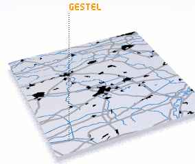 Places with similar names to Gestel, Belgium ::
Disclaimer :: Information on this page comes without warranty of any kind |
||
|
Where is Gestel? Elevation and coordinates ::
Latitude (lat): 51°7'0"N Longitude (lon): 5°7'0"E
Elevation (approx.): 23m (map arrows pan, magnifying glasses zoom) |
||
|
Visiting Gestel? Hotel/Accommodation ::
Book a hotel in Gestel Travel Guide ::
Buy a travel guide for Belgium rental cars ::
car rental offers GPS waypoint ::
download a GPX waypoint (PoI) of Gestel for your GPS receiver
|
||