|
search place name
|
||
Heer (Namur, Belgium)Heer is a town in the Namur region of Belgium. An overview map of the region around Heer is displayed below.
regional and 3d topo map of Heer, Belgium ::

Heer airports ::
The nearest airport is CRL - Charleroi Brussels South, located 42.3 km north west of Heer.
Other airports nearby include LGG - Liege (68.0 km north east), BRU - Brussels Natl (Melsbroek) (85.4 km north), MST - Maastricht (106.2 km north east), RHE - Reims Champagne (110.8 km south west), Nearby towns ::
Faubourg (0.0km north) //
Bac du Prince (1.2km west) //
Massembre (1.9km south) //
Agimont (2.4km west) //
Blaimont (3.7km north) //
Courvite (2.4km east) //
Givet (3.7km south) //
Hermeton-sur-Meuse (3.9km north) //
Mon Idée (3.0km south west) //
Fromelennes (4.4km south east) //
Hastière-Lavaux (5.6km north) //
Hastière-par-delà (5.6km north) //
Mesnil-Saint-Blaise (3.6km east) //
Rancennes (5.7km south) //
Insemont (5.7km north) //
Les Journeux (6.0km north west) //
Waulsort (6.0km north east) //
Belair (6.0km south east) //
Les Trois Fontaines (5.1km south west) //
Maurenne (7.5km north) //
Gochenée (5.1km west) //
Lenne (7.5km north) //
Charnois (7.5km south) //
Les Baraques (5.1km east) //
Périmont (7.5km south) //
Ham-sur-Meuse (6.6km south west) //
Dion (6.6km south east) //
Foisches (6.0km south west) //
Chooz (7.8km south) //
[all distances 'as the bird flies' and approximate] 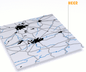 Places with similar names to Heer, Belgium ::
Disclaimer :: Information on this page comes without warranty of any kind |
||
|
Where is Heer? Elevation and coordinates ::
Latitude (lat): 50°10'0"N Longitude (lon): 4°50'0"E
Elevation (approx.): 179m (map arrows pan, magnifying glasses zoom) |
||
|
Visiting Heer? Hotel/Accommodation ::
Book a hotel in Heer Travel Guide ::
Buy a travel guide for Belgium rental cars ::
car rental offers GPS waypoint ::
download a GPX waypoint (PoI) of Heer for your GPS receiver
|
||