|
search place name
|
||
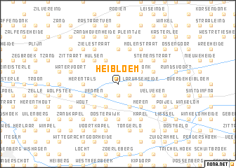
Heibloem (Antwerpen, Belgium)Heibloem is a town in the Antwerpen region of Belgium. An overview map of the region around Heibloem is displayed below.
regional and 3d topo map of Heibloem, Belgium ::
Heibloem airports ::
The nearest airport is ANR - Antwerp Deurne, located 29.6 km west of Heibloem.
Other airports nearby include BRU - Brussels Natl (Melsbroek) (42.0 km south west), EIN - Eindhoven (45.3 km north east), WOE - Woensdrecht (47.9 km north west), MST - Maastricht (69.1 km south east), Nearby towns ::
Gerheiden (1.9km south) //
Nederbuul (1.9km south) //
Doffen (1.9km south) //
Nederheide (1.2km east) //
Sint-Jozef-Olen (1.2km east) //
Gerheze (2.2km south west) //
Gerhagen (2.2km south east) //
Achter Olen (2.2km south east) //
Boekel (2.2km south east) //
Larumseheide (2.3km east) //
Vennen (3.0km south west) //
Schaatsbergen (3.9km south) //
Hoogbuul (3.9km south) //
Kruisweg (3.9km south) //
Heerle (3.9km north) //
Achterlee (3.9km north) //
Weidonk (3.0km north east) //
Eerselingen (3.0km north east) //
Olen (4.4km south west) //
Hulsen (4.4km north west) //
Meren (4.4km south east) //
Hukkelberg (4.4km north east) //
Tielen (5.6km north) //
Herentals (3.5km west) //
Oevel (5.6km south) //
Ill (5.6km south) //
Velveken (3.9km south east) //
Binneneinde (3.9km south east) //
Buitenste Einde (3.9km south east) //
[all distances 'as the bird flies' and approximate] 
Disclaimer :: Information on this page comes without warranty of any kind |
||
|
Where is Heibloem? Elevation and coordinates ::
Latitude (lat): 51°11'0"N Longitude (lon): 4°53'0"E
Elevation (approx.): 16m (map arrows pan, magnifying glasses zoom) |
||
|
Visiting Heibloem? Hotel/Accommodation ::
Book a hotel in Heibloem Travel Guide ::
Buy a travel guide for Belgium rental cars ::
car rental offers GPS waypoint ::
download a GPX waypoint (PoI) of Heibloem for your GPS receiver
|
||