|
search place name
|
||
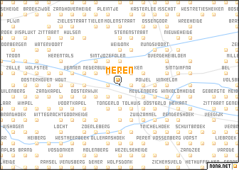
Meren (Antwerpen, Belgium)Meren is a town in the Antwerpen region of Belgium. An overview map of the region around Meren is displayed below.
regional and 3d topo map of Meren, Belgium ::
Meren airports ::
The nearest airport is ANR - Antwerp Deurne, located 32.2 km west of Meren.
Other airports nearby include BRU - Brussels Natl (Melsbroek) (41.0 km south west), EIN - Eindhoven (46.2 km north east), WOE - Woensdrecht (52.1 km north west), MST - Maastricht (65.5 km south east), Nearby towns ::
Heze (1.2km east) //
Kruisweg (1.2km west) //
Hoogbuul (1.2km west) //
Houdt (1.9km south) //
Kapel (1.9km south) //
Duitschool (1.9km south) //
Velveken (2.2km north east) //
Buitenste Einde (2.2km north east) //
Binneneinde (2.2km north east) //
Gerhagen (2.2km north west) //
Achter Olen (2.2km north west) //
Heieinde (2.2km south west) //
Boekel (2.2km north west) //
Mostdonk (3.7km south) //
Poijel (2.3km east) //
Larumseheide (3.7km north) //
Hondseinde (3.9km south) //
Tolhuis (3.9km south) //
Hannekenshoek (3.9km south) //
Tongerlo (3.9km south) //
Het Punt (3.0km south east) //
Liessel (3.0km south east) //
Liesselseheide (3.0km south east) //
Meulenberg (3.0km south east) //
Larum (3.0km north east) //
Rauwelkoven (3.0km north east) //
Sint-Jozef-Olen (3.9km north) //
Nederheide (3.9km north) //
Oevel (3.0km south west) //
[all distances 'as the bird flies' and approximate] 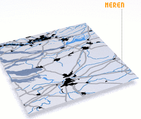 Places with similar names to Meren, Belgium ::
Disclaimer :: Information on this page comes without warranty of any kind |
||
|
Where is Meren? Elevation and coordinates ::
Latitude (lat): 51°9'0"N Longitude (lon): 4°55'0"E
Elevation (approx.): 22m (map arrows pan, magnifying glasses zoom) |
||
|
Visiting Meren? Hotel/Accommodation ::
Book a hotel in Meren Travel Guide ::
Buy a travel guide for Belgium rental cars ::
car rental offers GPS waypoint ::
download a GPX waypoint (PoI) of Meren for your GPS receiver
|
||