|
search place name
|
||
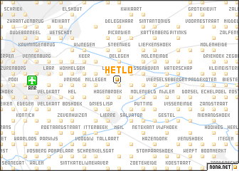
Het Lo (Antwerpen, Belgium)Het Lo is a town in the Antwerpen region of Belgium. An overview map of the region around Het Lo is displayed below.
regional and 3d topo map of Het Lo, Belgium ::
Het Lo airports ::
The nearest airport is ANR - Antwerp Deurne, located 8.6 km west of Het Lo.
Other airports nearby include BRU - Brussels Natl (Melsbroek) (32.1 km south), WOE - Woensdrecht (34.0 km north west), EIN - Eindhoven (62.6 km north east), CRL - Charleroi Brussels South (81.1 km south), Nearby towns ::
Moor (0.0km north) //
Pertendonk (0.0km north) //
Litzemaarheide (1.9km south) //
Nierlenders (1.2km east) //
Broechem (1.2km east) //
Hagenbroek (2.2km south west) //
Het Ven (2.2km south east) //
Hoog Tongel (2.2km south east) //
Emblem (2.2km south east) //
Laar (2.2km north west) //
Den Bastiaan (2.2km north east) //
De Bist (2.2km north east) //
Millegem (2.3km west) //
Schapenvondert (2.3km west) //
Oelegem (3.7km north) //
Bergse Hoeven (2.3km east) //
Mollent (2.3km east) //
Lisp (3.9km south) //
Allierseheide (3.9km south) //
Ranst (3.0km north west) //
Schavijk (3.0km north west) //
Kloosterheide (3.9km south) //
Molenveld (3.0km south east) //
Massenhoven (3.0km north east) //
Dries (4.4km south west) //
Klaplaar (4.4km south west) //
Eenhoorn (4.4km north west) //
Putting (4.4km south east) //
Bist (4.4km south east) //
[all distances 'as the bird flies' and approximate]  Places with similar names to Het Lo, Belgium ::
Disclaimer :: Information on this page comes without warranty of any kind |
||
|
Where is Het Lo? Elevation and coordinates ::
Latitude (lat): 51°11'0"N Longitude (lon): 4°35'0"E
Elevation (approx.): 10m (map arrows pan, magnifying glasses zoom) |
||
|
Visiting Het Lo? Hotel/Accommodation ::
Book a hotel in Het Lo Travel Guide ::
Buy a travel guide for Belgium rental cars ::
car rental offers GPS waypoint ::
download a GPX waypoint (PoI) of Het Lo for your GPS receiver
|
||