|
search place name
|
||
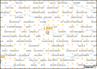
Laar (Antwerpen, Belgium)Laar is a town in the Antwerpen region of Belgium. An overview map of the region around Laar is displayed below.
regional and 3d topo map of Laar, Belgium ::
Laar airports ::
The nearest airport is ANR - Antwerp Deurne, located 24.5 km north west of Laar.
Other airports nearby include BRU - Brussels Natl (Melsbroek) (26.2 km south west), WOE - Woensdrecht (51.2 km north west), EIN - Eindhoven (61.0 km north east), LGG - Liege (68.3 km south east), Nearby towns ::
Heidelo (1.2km west) //
Hogeweg (1.2km east) //
Zonderschot (1.2km west) //
Kievit (1.9km south) //
Kwadenplas (1.9km south) //
Wishagen (2.2km north east) //
Bruggeneind (2.2km north east) //
Booischot (2.2km south east) //
Nachtegaal (2.2km south west) //
Bos (2.3km west) //
Bernum (3.7km north) //
Pijpelheide (3.7km south) //
Meerhoek (3.7km south) //
Hallaardaard (3.0km north west) //
Hulshout (3.0km north east) //
Heist-op-den-Berg (3.0km north west) //
Boonmerkt (3.0km north west) //
Hallaar (3.0km north west) //
Den Hoek (3.0km south east) //
Goor (3.0km south west) //
Brand (3.0km south east) //
Eindeken (3.0km south east) //
Itegem (3.9km north) //
Brandhoek (3.9km north) //
Lichten (3.9km south) //
Bernum (4.4km north east) //
Hoogbraak (4.4km north east) //
Averechten (4.4km north west) //
Padde Poelen (4.4km south west) //
[all distances 'as the bird flies' and approximate] 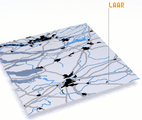 Places with similar names to Laar, Belgium ::
Disclaimer :: Information on this page comes without warranty of any kind |
||
|
Where is Laar? Elevation and coordinates ::
Latitude (lat): 51°4'0"N Longitude (lon): 4°45'0"E
Elevation (approx.): 8m (map arrows pan, magnifying glasses zoom) |
||
|
Visiting Laar? Hotel/Accommodation ::
Book a hotel in Laar Travel Guide ::
Buy a travel guide for Belgium rental cars ::
car rental offers GPS waypoint ::
download a GPX waypoint (PoI) of Laar for your GPS receiver
|
||