|
search place name
|
||
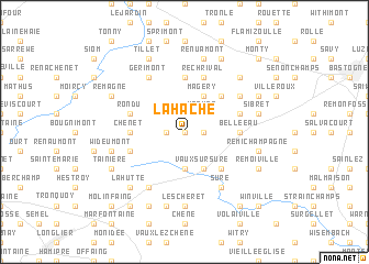
La Hache (Luxembourg, Belgium)La Hache is a town in the Luxembourg region of Belgium. An overview map of the region around La Hache is displayed below.
regional and 3d topo map of La Hache, Belgium ::
La Hache airports ::
The nearest airport is LUX - Luxemburg Luxembourg, located 58.7 km south east of La Hache.
Other airports nearby include LGG - Liege (77.0 km north), SPM - Spangdahlem Ab (80.8 km east), ZQF - Trier Fohren (88.3 km east), CRL - Charleroi Brussels South (97.6 km north west), Nearby towns ::
Remience (0.0km north) //
Au Chabet (1.2km east) //
La Damselle (1.2km west) //
Morhet (2.2km north east) //
Copon (2.2km north east) //
Grande Rosière (3.7km south) //
Vaux-lez-Rosières (3.7km south) //
Magerotte (3.9km north) //
Magery (3.9km north) //
Petite Rosière (3.9km south) //
Vaux-sur-Sûre (3.9km south) //
Champ Blandais (3.9km south) //
Lavaselle (4.4km north east) //
Nives (4.4km south east) //
Pinsamont (5.6km north) //
Chênet (3.6km west) //
Belle Eau (3.6km east) //
Rechrival (5.7km north) //
Houmont (5.7km north) //
Jodenville (4.0km north east) //
Rondu (4.0km north west) //
Nimbermont (4.0km north west) //
Hestrulle (4.0km south west) //
Mande Sainte-Marie (5.2km north east) //
Fontaine de Burton (5.2km north east) //
Sure (6.1km south east) //
Beau Plateau (6.0km north west) //
Gérimont (6.0km north west) //
Bercheux (6.1km south west) //
[all distances 'as the bird flies' and approximate]  Places with similar names to La Hache, Belgium ::
Disclaimer :: Information on this page comes without warranty of any kind |
||
|
Where is La Hache? Elevation and coordinates ::
Latitude (lat): 49°57'0"N Longitude (lon): 5°34'0"E
Elevation (approx.): 477m (map arrows pan, magnifying glasses zoom) |
||
|
Visiting La Hache? Hotel/Accommodation ::
Book a hotel in La Hache Travel Guide ::
Buy a travel guide for Belgium rental cars ::
car rental offers GPS waypoint ::
download a GPX waypoint (PoI) of La Hache for your GPS receiver
|
||