|
search place name
|
||
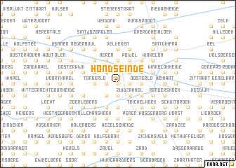
Hondseinde (Antwerpen, Belgium)Hondseinde is a town in the Antwerpen region of Belgium. An overview map of the region around Hondseinde is displayed below.
regional and 3d topo map of Hondseinde, Belgium ::
Hondseinde airports ::
The nearest airport is ANR - Antwerp Deurne, located 34.1 km west of Hondseinde.
Other airports nearby include BRU - Brussels Natl (Melsbroek) (39.6 km south west), EIN - Eindhoven (48.2 km north east), WOE - Woensdrecht (55.4 km north west), MST - Maastricht (63.0 km east), Nearby towns ::
Hannekenshoek (0.0km north) //
Tolhuis (0.0km north) //
Mostdonk (1.2km west) //
De Kat (1.2km east) //
Hazenhout (1.2km east) //
Paddenhoek (1.9km south) //
Brede Rijt (1.9km south) //
Houdt (2.2km north west) //
Duitschool (2.2km north west) //
Kapel (2.2km north west) //
Het Punt (2.2km north east) //
Liessel (2.2km north east) //
Liesselseheide (2.2km north east) //
Meulenberg (2.2km north east) //
Goorken (2.2km south west) //
Overwijs (2.2km south west) //
Zammel (2.2km south east) //
Zuidzammel (2.2km south east) //
Heze (3.7km north) //
Tongerlo (2.3km west) //
Den Veind (2.3km east) //
Oosterlo (2.3km east) //
Goorbeek (3.7km south) //
Meren (3.9km north) //
Heieinde (3.0km north west) //
Poijel (3.9km north) //
Stelen (3.0km north east) //
Westerlo (3.9km south) //
Zammelsbuitenbroek (3.0km south east) //
[all distances 'as the bird flies' and approximate] 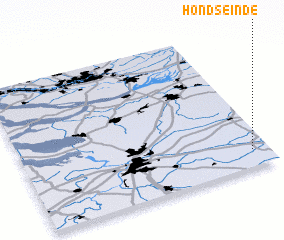 Places with similar names to Hondseinde, Belgium ::
Disclaimer :: Information on this page comes without warranty of any kind |
||
|
Where is Hondseinde? Elevation and coordinates ::
Latitude (lat): 51°7'0"N Longitude (lon): 4°56'0"E
Elevation (approx.): 16m (map arrows pan, magnifying glasses zoom) |
||
|
Visiting Hondseinde? Hotel/Accommodation ::
Book a hotel in Hondseinde Travel Guide ::
Buy a travel guide for Belgium rental cars ::
car rental offers GPS waypoint ::
download a GPX waypoint (PoI) of Hondseinde for your GPS receiver
|
||