|
search place name
|
||
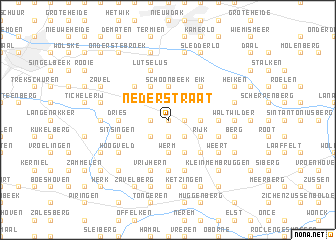
Nederstraat (Limburg, Belgium)Nederstraat is a town in the Limburg region of Belgium. An overview map of the region around Nederstraat is displayed below.
regional and 3d topo map of Nederstraat, Belgium ::
Nederstraat airports ::
The nearest airport is MST - Maastricht, located 20.8 km east of Nederstraat.
Other airports nearby include LGG - Liege (25.7 km south), GKE - Geilenkirchen (40.7 km east), EIN - Eindhoven (65.4 km north), BRU - Brussels Natl (Melsbroek) (70.4 km west), Nearby towns ::
Groenstraat (0.0km north) //
Penneel (1.2km west) //
Meerhem (1.2km east) //
Hoeselt (1.9km south) //
Laar (2.2km north west) //
Spurk (2.2km north east) //
Rooie (2.2km north east) //
Romershoven (2.2km south west) //
Kruis (2.2km south west) //
Hombroek (2.2km south west) //
Motmolen (2.2km south east) //
Broek (2.2km south east) //
Heesveld (3.7km north) //
Schoonbeek (3.7km north) //
Bilzen (2.3km east) //
Werm (3.7km south) //
Beverst (3.9km north) //
Buissen (3.0km north east) //
Broekem (3.0km north east) //
Munsterbilzen (3.0km north east) //
Rijk (3.0km south east) //
Leten (3.0km south east) //
Molenbroek (3.9km south) //
Grendelbaan (4.4km north west) //
Reitje (4.4km north west) //
Begeveld (4.4km north west) //
Appelveld (4.4km north west) //
Haag (4.4km north east) //
Eik (4.4km north east) //
[all distances 'as the bird flies' and approximate]  Places with similar names to Nederstraat, Belgium ::
Disclaimer :: Information on this page comes without warranty of any kind |
||
|
Where is Nederstraat? Elevation and coordinates ::
Latitude (lat): 50°52'0"N Longitude (lon): 5°29'0"E
Elevation (approx.): 81m (map arrows pan, magnifying glasses zoom) |
||
|
Visiting Nederstraat? Hotel/Accommodation ::
Book a hotel in Nederstraat Travel Guide ::
Buy a travel guide for Belgium rental cars ::
car rental offers GPS waypoint ::
download a GPX waypoint (PoI) of Nederstraat for your GPS receiver
|
||