|
search place name
|
||
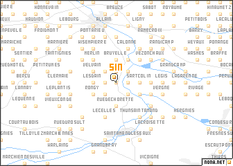
Sin (Hainaut, Belgium)Sin is a town in the Hainaut region of Belgium. An overview map of the region around Sin is displayed below.
regional and 3d topo map of Sin, Belgium ::
Sin airports ::
The nearest airport is LIL - Lille Lesquin, located 23.7 km west of Sin.
Other airports nearby include QKT - Kortrijk-vevelgem Wevelgem (36.6 km north west), CRL - Charleroi Brussels South (73.9 km east), OST - Oostende (85.3 km north west), BRU - Brussels Natl (Melsbroek) (86.7 km north east), Nearby towns ::
Espain (0.0km north) //
Gille Savoie (1.2km east) //
Laplaigne (1.2km east) //
Belloy (1.2km east) //
Hollain (1.9km north) //
Le Tombeau (1.9km north) //
Bléharies (1.2km west) //
Le Large (2.2km north east) //
Jollain-Merlin (2.2km north west) //
Maulde (2.2km south east) //
Quesnoy (2.2km south west) //
Bruyelle (3.7km north) //
Sart Colin (2.4km east) //
Petit Howardries (2.4km west) //
Lesdain (2.4km west) //
Rue de Chorette (3.7km south) //
Crèvecoeur (3.9km north) //
Péronnes (3.9km north) //
Mortagne-du-Nord (3.0km south east) //
Velvain (3.0km north west) //
Bouderets (3.0km north west) //
Rongy (3.0km south west) //
Rosoir (4.4km north east) //
Merlin (4.4km north west) //
Wez-Velvain (4.4km north west) //
Roeux (3.5km east) //
Calonne (5.7km north) //
Flines-lès-Mortagne (4.0km south east) //
Lecelles (5.7km south) //
[all distances 'as the bird flies' and approximate]  Places with similar names to Sin, Belgium ::
Disclaimer :: Information on this page comes without warranty of any kind |
||
|
Where is Sin? Elevation and coordinates ::
Latitude (lat): 50°31'0"N Longitude (lon): 3°25'0"E
Elevation (approx.): 27m (map arrows pan, magnifying glasses zoom) |
||
|
Visiting Sin? Hotel/Accommodation ::
Book a hotel in Sin Travel Guide ::
Buy a travel guide for Belgium rental cars ::
car rental offers GPS waypoint ::
download a GPX waypoint (PoI) of Sin for your GPS receiver
|
||