|
search place name
|
||
Te Berg (Liège, Belgium)Te Berg is a town in the Liège region of Belgium. An overview map of the region around Te Berg is displayed below.
regional and 3d topo map of Te Berg, Belgium ::

nearby GPS traces from timatio ::
Te Berg airports ::
The nearest airport is MST - Maastricht, located 26.2 km north west of Te Berg.
Other airports nearby include GKE - Geilenkirchen (30.0 km north), LGG - Liege (35.3 km west), MGL - Moenchengladbach Monchengladbach (71.4 km north east), CGN - Cologne Koln Bonn (87.3 km east), Nearby towns ::
Patloy (0.0km north) //
Gensterbloem (1.2km west) //
Belven (1.9km north) //
Stadt (1.9km north) //
Bömken (1.2km east) //
Vivier (1.9km south) //
Gulpen (2.2km north west) //
Berlieren (2.2km north west) //
Labach (2.2km north west) //
Hombourg (2.2km north west) //
Gulpenmeule (2.2km north west) //
Birven (2.2km south west) //
La Vlamerie (2.2km south west) //
Rouscheweide (2.2km north east) //
Schwarzenberg (2.2km north east) //
Ruyff (2.2km south east) //
Bisweg (3.7km north) //
Hindel (3.7km north) //
La Clouse (2.3km west) //
Henri-Chapelle (3.7km south) //
Birken (2.3km east) //
Montzen (2.3km east) //
Overstehindel (3.9km north) //
Gronenschild (3.9km north) //
Hochelbach (3.9km south) //
Vosheydt (3.9km north) //
Plombières (3.9km north) //
Boffereth (3.9km north) //
Chevemont (3.0km north west) //
[all distances 'as the bird flies' and approximate] 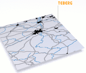 Places with similar names to Te Berg, Belgium ::
Disclaimer :: Information on this page comes without warranty of any kind |
||
|
Where is Te Berg? Elevation and coordinates ::
Latitude (lat): 50°42'0"N Longitude (lon): 5°56'0"E
Elevation (approx.): 259m (map arrows pan, magnifying glasses zoom) |
||
|
Visiting Te Berg? Hotel/Accommodation ::
Book a hotel in Te Berg Travel Guide ::
Buy a travel guide for Belgium rental cars ::
car rental offers GPS waypoint ::
download a GPX waypoint (PoI) of Te Berg for your GPS receiver
|
||