|
search place name
|
||
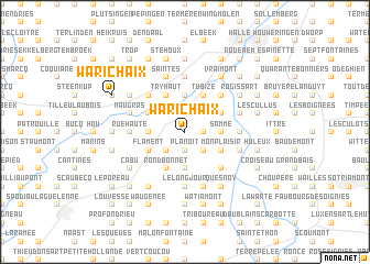
Warichaix (Hainaut, Belgium)Warichaix is a town in the Hainaut region of Belgium. An overview map of the region around Warichaix is displayed below.
regional and 3d topo map of Warichaix, Belgium ::
Warichaix airports ::
The nearest airport is CRL - Charleroi Brussels South, located 28.6 km south east of Warichaix.
Other airports nearby include BRU - Brussels Natl (Melsbroek) (35.1 km north east), ANR - Antwerp Deurne (63.1 km north), QKT - Kortrijk-vevelgem Wevelgem (71.5 km west), LIL - Lille Lesquin (78.1 km west), Nearby towns ::
Bouton Rouge (1.2km east) //
Le Rossignol (1.2km east) //
Dujacquier (1.2km east) //
Planoit (1.9km south) //
Aulnois (1.9km south) //
Le Renard (1.9km north) //
Coeurq (1.9km north) //
Ardennes (1.9km south) //
Hennuyères (2.2km south west) //
Basse Bruyère (2.2km south east) //
Virginal-Samme (2.2km south east) //
Haute Bruyère (2.2km south east) //
Stéhoux (2.2km north east) //
Flinchaux (3.7km south) //
La Genette (2.4km west) //
Ophain (3.7km north) //
Ripain (3.7km north) //
Samme (2.4km east) //
Le Marouset (3.9km south) //
Basse Houssière (3.9km south) //
Rond Bonnet (3.9km south) //
Try Haut (3.9km north) //
Quenast (3.0km north west) //
Buissot (3.0km north west) //
Flament (3.0km south west) //
Tubize (3.9km north) //
Naarmonts (3.9km north) //
Monplaisir (3.0km south east) //
Oisquercq (3.0km north east) //
[all distances 'as the bird flies' and approximate]  Places with similar names to Warichaix, Belgium ::
Disclaimer :: Information on this page comes without warranty of any kind |
||
|
Where is Warichaix? Elevation and coordinates ::
Latitude (lat): 50°39'0"N Longitude (lon): 4°11'0"E
Elevation (approx.): 78m (map arrows pan, magnifying glasses zoom) |
||
|
Visiting Warichaix? Hotel/Accommodation ::
Book a hotel in Warichaix Travel Guide ::
Buy a travel guide for Belgium rental cars ::
car rental offers GPS waypoint ::
download a GPX waypoint (PoI) of Warichaix for your GPS receiver
|
||