|
search place name
|
||
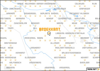
Broekkant (Noord-Brabant, Netherlands)Broekkant is a town in the Noord-Brabant region of Netherlands. An overview map of the region around Broekkant is displayed below.
regional and 3d topo map of Broekkant, Netherlands ::
Broekkant airports ::
The nearest airport is EIN - Eindhoven, located 39.9 km south west of Broekkant.
Other airports nearby include UTC - Soesterberg (64.0 km north west), MGL - Moenchengladbach Monchengladbach (67.3 km south east), DUS - Duesseldorf Dusseldorf (77.2 km south east), GKE - Geilenkirchen (79.9 km south), Nearby towns ::
De Berg (1.1km west) //
De Boer (1.1km west) //
De Hoef (1.1km west) //
Velorenhoek (1.1km west) //
Park (1.9km south) //
Ham (1.9km south) //
Peelstraat (1.9km south) //
Sint Hubert (2.2km north west) //
Hoeven (2.2km south west) //
Wanroij (2.2km south west) //
Walsert (2.2km south east) //
Hulsbeek (2.2km south east) //
Lamper (2.2km south east) //
Laageind (2.3km east) //
Molengat (3.0km north west) //
Noord (3.0km south west) //
Haps (3.0km north east) //
Putselaar (3.0km north east) //
Papenvoort (3.0km south east) //
Ullingen (3.9km south) //
Haring (4.4km north east) //
Toven (4.4km south east) //
De Heuf (5.6km north) //
Beers (5.6km north) //
Mill (3.9km north west) //
Molenheide (3.9km north west) //
Vlagberg (5.7km south) //
Vianen (5.7km north) //
Rijkevoort (3.9km south east) //
[all distances 'as the bird flies' and approximate]  Places with similar names to Broekkant, Netherlands ::
// Burkuntē (ET)
// Bergante (PH)
// Borgunto (IT)
// Brugneto (IT)
// Börgönd (HU)
// Bergüenda (ES)
// Burgunda (RU)
// Burgunda (RU)
// Bāraikānda (BD)
// Barai Kāndi (BD)
Disclaimer :: Information on this page comes without warranty of any kind |
||
|
Where is Broekkant? Elevation and coordinates ::
Latitude (lat): 51°40'0"N Longitude (lon): 5°50'0"E
Elevation (approx.): 11m (map arrows pan, magnifying glasses zoom) |
||
|
Visiting Broekkant? Hotel/Accommodation ::
Book a hotel in Broekkant Travel Guide ::
Buy a travel guide for Netherlands rental cars ::
car rental offers GPS waypoint ::
download a GPX waypoint (PoI) of Broekkant for your GPS receiver
|
||