|
search place name
|
||
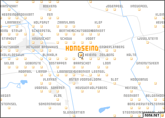
Hondseind (Noord-Brabant, Netherlands)Hondseind is a town in the Noord-Brabant region of Netherlands. An overview map of the region around Hondseind is displayed below.
regional and 3d topo map of Hondseind, Netherlands ::
Hondseind airports ::
The nearest airport is EIN - Eindhoven, located 27.3 km west of Hondseind.
Other airports nearby include MGL - Moenchengladbach Monchengladbach (56.9 km south east), GKE - Geilenkirchen (57.7 km south), MST - Maastricht (59.9 km south), DUS - Duesseldorf Dusseldorf (71.9 km east), Nearby towns ::
Vloeieind (0.0km north) //
Vlierden (0.0km north) //
Grote Bottel (1.2km east) //
Heieind (1.2km east) //
De Hees (1.2km west) //
Schooteind (1.2km west) //
Baarschot (1.9km south) //
Kerkeind (2.2km north east) //
Kleine Bottel (2.2km north east) //
Belgeren (2.2km south west) //
Ommelschebosch (2.2km south west) //
Groot Bruggen (3.7km north) //
Klein Bruggen (3.7km north) //
Vreewijk (2.3km east) //
De Berken (3.7km south) //
Stegen (3.7km south) //
Voorste Beersdonk (2.3km west) //
Voort (3.9km north) //
Rinkveld (3.9km south) //
Achterbosch (3.9km south) //
Hilakker (3.9km north) //
Molenhof (3.9km north) //
Wasberg (3.0km north east) //
Walsberg (3.0km north east) //
Deurne (3.0km north east) //
Heimolen (3.0km south east) //
Ommel (3.9km south) //
Leensel (4.4km south east) //
Schouw (4.4km north west) //
[all distances 'as the bird flies' and approximate]  Places with similar names to Hondseind, Netherlands ::
Disclaimer :: Information on this page comes without warranty of any kind |
||
|
Where is Hondseind? Elevation and coordinates ::
Latitude (lat): 51°27'0"N Longitude (lon): 5°46'0"E
Elevation (approx.): 22m (map arrows pan, magnifying glasses zoom) |
||
|
Visiting Hondseind? Hotel/Accommodation ::
Book a hotel in Hondseind Travel Guide ::
Buy a travel guide for Netherlands rental cars ::
car rental offers GPS waypoint ::
download a GPX waypoint (PoI) of Hondseind for your GPS receiver
|
||