|
search place name
|
||
Dhóxa (Piraiévs, Greece)Dhóxa is a town in the Piraiévs region of Greece. An overview map of the region around Dhóxa is displayed below.
regional and 3d topo map of Dhóxa, Greece ::

Dhóxa airports ::
The nearest airport is PYR - Andravida, located 60.2 km north west of Dhóxa.
Other airports nearby include GPA - Patras Araxos (66.1 km north west), KLX - Kalamata (70.8 km south), ZTH - Zakynthos Dionysios Solomos (91.2 km west), AGQ - Agrinion (111.7 km north west), Nearby towns ::
Kalliánion (1.9km south) //
Stavrodhrómion (2.9km east) //
Aëtorrákhi (3.7km south) //
Skoúndon (4.0km north) //
Kokkinórrakhi (4.0km south) //
Vizíkion (3.5km north east) //
Trópaia (4.7km north east) //
Fouskári (4.4km east) //
Lissaréa (5.8km south) //
Spátharis (5.7km north) //
Touthóa (4.8km south east) //
Levkokhórion (4.8km south east) //
Fanarákion (4.8km south west) //
Ókhthia (5.8km south) //
Kastrákion (5.8km south west) //
Arápidhes (6.3km south east) //
Ergotázion Ládhonos (6.3km north west) //
Galatás (6.2km east) //
Sarakínion (7.6km south) //
Parnassós (7.6km south) //
Katsouliá (6.9km north east) //
Psárion (8.0km south) //
Loutrá (8.0km south) //
Sérvos (8.1km south east) //
Voútsis (8.6km north west) //
Vlákhoi (8.1km south west) //
Ayionérion (8.6km south west) //
Likoúresis (9.5km south east) //
Liodhóra (9.5km south west) //
[all distances 'as the bird flies' and approximate] 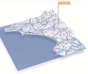 Places with similar names to Dhóxa, Greece ::
// Deh-e Qāẕī (IR)
// Deh-e Qāẕī (IR)
// Deh-e Qāzī (IR)
// Dhok Ghāzi (PK)
// Tahuacasi (PE)
// De Haukes (NL)
// Deh-e Qāẕī (IR)
// Deh-e Qāẕī (IR)
// Dahexu (CN)
// Taihexu (CN)
Disclaimer :: Information on this page comes without warranty of any kind |
||
|
Where is Dhóxa? Elevation and coordinates ::
Latitude (lat): 37°42'0"N Longitude (lon): 21°55'0"E
Elevation (approx.): 506m (map arrows pan, magnifying glasses zoom) |
||
|
Visiting Dhóxa? Hotel/Accommodation ::
Book a hotel in Dhóxa Travel Guide ::
Buy a travel guide for Greece rental cars ::
car rental offers GPS waypoint ::
download a GPX waypoint (PoI) of Dhóxa for your GPS receiver
|
||