|
search place name
|
||
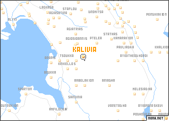
Kalívia (Piraiévs, Greece)Kalívia is a town in the Piraiévs region of Greece. An overview map of the region around Kalívia is displayed below.
regional and 3d topo map of Kalívia, Greece ::
Kalívia airports ::
The nearest airport is PVK - Preveza Aktio, located 39.4 km west of Kalívia.
Other airports nearby include AGQ - Agrinion (42.1 km south), IOA - Ioannina (87.9 km north west), GPA - Patras Araxos (92.3 km south), EFL - Keffallinia Kefallinia (112.8 km south west), Nearby towns ::
Xirolívadhon (1.4km west) //
Loutrón (2.3km south west) //
Tsoúkka (2.9km west) //
Triantafylloúla (3.8km north west) //
Ágios Ioánnis (4.0km north) //
Krikellos (3.4km south west) //
Pteléa (4.5km north east) //
Ambelákion (5.6km south) //
Anoixiátikon (4.3km west) //
Petrálona (5.7km south) //
Agía Triás (6.0km north) //
Plakotí (5.8km north west) //
Xirakiá (5.8km east) //
Arápis (5.8km west) //
Stathás (6.6km north east) //
Ariádha (7.0km south east) //
Katáfourkon (6.7km north west) //
Boúkka (6.9km south west) //
Kechrí (8.6km north) //
Kamarákion (7.8km north east) //
Mourtaíika (9.4km north east) //
Agrídion (9.3km north east) //
Elaiochórion (9.2km north west) //
Vromonérion (9.1km north east) //
Néon Agrídion (10.1km north east) //
Skatzókampos (10.1km north east) //
(( Tsaknochórion )) (10.4km north west) //
Grammatsoúli (10.8km north east) //
[all distances 'as the bird flies' and approximate] 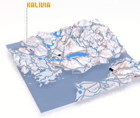 Places with similar names to Kalívia, Greece ::
Disclaimer :: Information on this page comes without warranty of any kind |
||
|
Where is Kalívia? Elevation and coordinates ::
Latitude (lat): 38°58'0"N Longitude (lon): 21°13'0"E
Elevation (approx.): 179m (map arrows pan, magnifying glasses zoom) |
||
|
Visiting Kalívia? Hotel/Accommodation ::
Book a hotel in Kalívia Travel Guide ::
Buy a travel guide for Greece rental cars ::
car rental offers GPS waypoint ::
download a GPX waypoint (PoI) of Kalívia for your GPS receiver
|
||