|
search place name
|
||
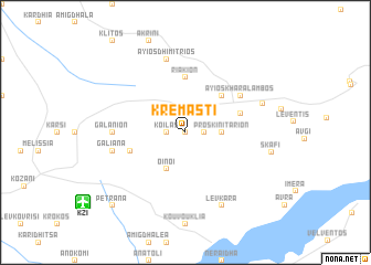
Kremastí (Piraiévs, Greece)Kremastí is a town in the Piraiévs region of Greece. An overview map of the region around Kremastí is displayed below.
regional and 3d topo map of Kremastí, Greece ::
Kremastí airports ::
The nearest airport is KZI - Kozani Filippos, located 10.6 km south west of Kremastí.
Other airports nearby include KSO - Kastoria Aristotelis (56.3 km west), LRA - Larissa Larisa (90.0 km south east), SKG - Thessaloniki Makedonia (90.0 km east), IOA - Ioannina (119.4 km south west), Nearby towns ::
Amigdhaléa (0.0km north) //
Koilás (1.4km west) //
Thimariá (1.4km east) //
Proskinitárion (2.8km east) //
Oinóï (4.0km south) //
Tetrálofon (4.7km north east) //
Riákion (5.6km north) //
Pteléa (4.6km south west) //
Kapnokhórion (4.6km north east) //
Anatolikón (4.6km north east) //
Áyios Kharálambos (5.6km north east) //
Galánion (5.6km west) //
Galiána (5.9km west) //
Áyios Dhimítrios (7.5km north) //
Lévkara (7.9km south) //
Voskochórion (6.6km north east) //
Skáfi (6.9km east) //
Petraná (9.3km south west) //
[all distances 'as the bird flies' and approximate] 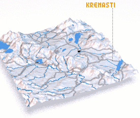 Places with similar names to Kremastí, Greece ::
// Grimisuat (CH)
// Grimzdai (LT)
// Grămeşti (RO)
// Keramzit (RU)
// Cream City (US)
// Guarimacito (CO)
// Karamsad (IN)
// Karm Saddé (LB)
// Kirimassidi (NE)
// Karam Bast (IR)
Disclaimer :: Information on this page comes without warranty of any kind |
||
|
Where is Kremastí? Elevation and coordinates ::
Latitude (lat): 40°21'0"N Longitude (lon): 21°56'0"E
Elevation (approx.): 850m (map arrows pan, magnifying glasses zoom) |
||
|
Visiting Kremastí? Hotel/Accommodation ::
Book a hotel in Kremastí Travel Guide ::
Buy a travel guide for Greece rental cars ::
car rental offers GPS waypoint ::
download a GPX waypoint (PoI) of Kremastí for your GPS receiver
|
||