|
search place name
|
||
Stalós (Piraiévs, Greece)Stalós is a town in the Piraiévs region of Greece. An overview map of the region around Stalós is displayed below.
regional and 3d topo map of Stalós, Greece ::

Stalós airports ::
The nearest airport is CHQ - Chania Souda, located 19.9 km east of Stalós.
Other airports nearby include HER - Heraklion Nikos Kazantzakis (114.6 km east), KIT - Kithira (119.3 km north west), JTR - Santorini (171.5 km north east), KLX - Kalamata (244.2 km north west), Nearby towns ::
Troúlous (0.0km north) //
Metókhi (0.0km north) //
Ayía Marína (1.9km north) //
Kirtomádhos (2.4km south west) //
Plataniás (2.4km north west) //
Ayiás Filakaí (2.4km south east) //
Ayiá (3.7km south) //
Dhrakianá (3.0km west) //
Sikoliá (3.0km east) //
Galatás (3.0km east) //
Episkopí (4.0km south) //
Milonianá (4.0km south) //
Patellárion (3.5km south west) //
Marmarás (3.5km south east) //
Pírgos (3.5km north east) //
Potistíria (3.5km south east) //
Kolimvíthra (3.5km north east) //
Liyidhés (3.5km south east) //
Mourí (4.8km south west) //
Gavranoú (4.8km south west) //
Koufós (4.8km south west) //
Varípetron (4.8km south east) //
Vrísai (4.5km west) //
Dharátsos (4.5km east) //
SFakianalíon (4.5km east) //
Áptera (4.5km east) //
Alikianós (5.8km south) //
Ptinotrofíon (4.9km west) //
Hají Yelási (4.9km east) //
[all distances 'as the bird flies' and approximate] 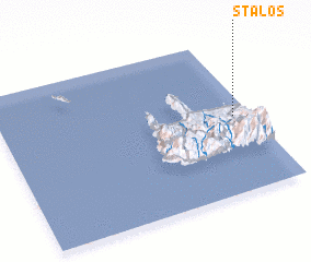 Places with similar names to Stalós, Greece ::
Disclaimer :: Information on this page comes without warranty of any kind |
||
|
Where is Stalós? Elevation and coordinates ::
Latitude (lat): 35°30'0"N Longitude (lon): 23°56'0"E
Elevation (approx.): 79m (map arrows pan, magnifying glasses zoom) |
||
|
Visiting Stalós? Hotel/Accommodation ::
Book a hotel in Stalós Travel Guide ::
Buy a travel guide for Greece rental cars ::
car rental offers GPS waypoint ::
download a GPX waypoint (PoI) of Stalós for your GPS receiver
|
||