|
search place name
|
||
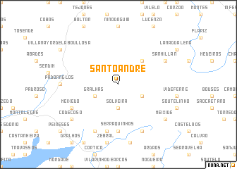
Santo André (Vila Real, Portugal)Santo André is a town in the Vila Real region of Portugal. An overview map of the region around Santo André is displayed below.
regional and 3d topo map of Santo André, Portugal ::
Santo André airports ::
The nearest airport is VRL - Vila Real, located 65.9 km south of Santo André.
Other airports nearby include BGC - Braganca (79.7 km east), VGO - Vigo (89.2 km north west), OPO - Porto (109.0 km south west), SCQ - Santiago (129.9 km north west), Nearby towns ::
Solveira (3.7km south) //
Gralhas (3.3km south west) //
Vilar de Perdizes (3.3km south east) //
Gironda (4.6km north east) //
Serraquinhos (7.4km south) //
Sepeda (7.5km south) //
Meixedo (6.7km south west) //
San Millán (6.6km north east) //
Aldeia Nova de São Mateus (7.9km south) //
Pedrário (7.9km south) //
Codeçoso (7.8km south west) //
Meixide (7.8km south east) //
[all distances 'as the bird flies' and approximate] 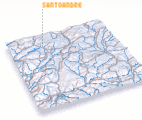 Places with similar names to Santo André, Portugal ::
// Santana do Ouro (BR)
// Santo André (BR)
// Santo André (BR)
// Santo André (BR)
// Santo André (BR)
// Santo André (BR)
// Santo André (BR)
// Santo André (BR)
// Santo André (BR)
// Saint Andrew (US)
Disclaimer :: Information on this page comes without warranty of any kind |
||
|
Where is Santo André? Elevation and coordinates ::
Latitude (lat): 41°52'0"N Longitude (lon): 7°40'0"W
Elevation (approx.): 837m (map arrows pan, magnifying glasses zoom) |
||
|
Visiting Santo André? Hotel/Accommodation ::
Book a hotel in Santo André Travel Guide ::
Buy a travel guide for Portugal rental cars ::
car rental offers GPS waypoint ::
download a GPX waypoint (PoI) of Santo André for your GPS receiver
|
||