|
search place name
|
||
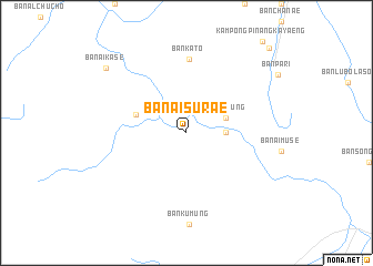
Ban Ai Su Rae (Narathiwat, Thailand)Ban Ai Su Rae is a town in the Narathiwat region of Thailand. An overview map of the region around Ban Ai Su Rae is displayed below.
regional and 3d topo map of Ban Ai Su Rae, Thailand ::
Ban Ai Su Rae airports ::
The nearest airport is NAW - Narathiwat, located 55.7 km north of Ban Ai Su Rae.
Other airports nearby include KBR - Kota Bahru Sultan Ismail Petra (76.6 km east), PAN - Pattani (97.6 km north west), AOR - Alor Setar Sultan Abdul Halim (135.7 km west), HDY - Songkhla Hat Yai Intl (167.8 km north west), Nearby towns ::
Kampong Kamung (3.9km east) //
Ban Ku Mung (4.2km east) //
Ban Ai Bu Tae (5.4km west) //
Ban Ka To (7.4km north) //
Ban Ai Ka Se (10.3km north west) //
Chanae (12.0km north east) //
[all distances 'as the bird flies' and approximate]  Places with similar names to Ban Ai Su Rae, Thailand ::
// Banasra (IQ)
// Ban Sai Ra (TH)
// Ban Sai Ra (TH)
// Ban Sarai (TH)
// Ban Sarai (TH)
// Ban Sa Ri (TH)
// Ban Sari (TH)
// Ban Si-re (TH)
// Ban Sire (TH)
// Ban Si Roi (TH)
Disclaimer :: Information on this page comes without warranty of any kind |
||
|
Where is Ban Ai Su Rae? Elevation and coordinates ::
Latitude (lat): 6°2'0"N Longitude (lon): 101°36'52"E
Elevation (approx.): 98m (map arrows pan, magnifying glasses zoom) |
||
|
Visiting Ban Ai Su Rae? Hotel/Accommodation ::
Book a hotel in Ban Ai Su Rae Travel Guide ::
Buy a travel guide for Thailand rental cars ::
car rental offers GPS waypoint ::
download a GPX waypoint (PoI) of Ban Ai Su Rae for your GPS receiver
|
||