|
search place name
|
||
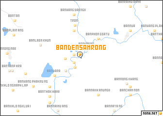
Ban Den Samrong (Uttaradit, Thailand)Ban Den Samrong is a town in the Uttaradit region of Thailand. An overview map of the region around Ban Den Samrong is displayed below.
regional and 3d topo map of Ban Den Samrong, Thailand ::
Ban Den Samrong airports ::
The nearest airport is PHS - Phitsanulok, located 71.1 km south of Ban Den Samrong.
Other airports nearby include PRH - Phrae (80.0 km north), LPT - Lampang (116.3 km north west), LOE - Loei (168.9 km east), Nearby towns ::
Ban Hat Song Khwae (1.8km north west) //
Ban Tao Hai (2.0km south west) //
Ban Kaeng (2.5km north east) //
Ban Tao Hai Tai (2.6km south west) //
Ban Tha Sak (3.5km west) //
Ban Wang Sammo (1) (4.5km south west) //
Ban Phong Satu (5.7km north east) //
Ban Mai (1) (6.5km north) //
Bang Wang Hin (1) (6.5km north) //
Ban Dara (7.2km south west) //
Tron (7.7km north) //
Ban Na Khanung (1) (9.3km south east) //
Ban Rai Oi (9.7km south west) //
Ban Tha Kham (1) (11.2km south west) //
[all distances 'as the bird flies' and approximate] 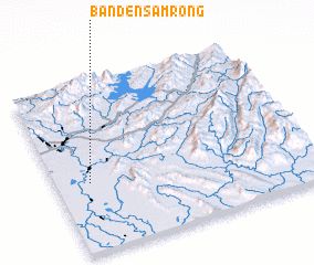 Places with similar names to Ban Den Samrong, Thailand ::
// Ban Don Samrong (TH)
// Ban Don Samrong (TH)
// Ban Don Samrong (TH)
// Ban Don Samrong (TH)
// Ban Ton Samrong (TH)
Disclaimer :: Information on this page comes without warranty of any kind |
||
|
Where is Ban Den Samrong? Elevation and coordinates ::
Latitude (lat): 17°24'36"N Longitude (lon): 100°7'57"E
Elevation (approx.): 58m (map arrows pan, magnifying glasses zoom) |
||
|
Visiting Ban Den Samrong? Hotel/Accommodation ::
Book a hotel in Ban Den Samrong Travel Guide ::
Buy a travel guide for Thailand rental cars ::
car rental offers GPS waypoint ::
download a GPX waypoint (PoI) of Ban Den Samrong for your GPS receiver
|
||