|
search place name
|
||
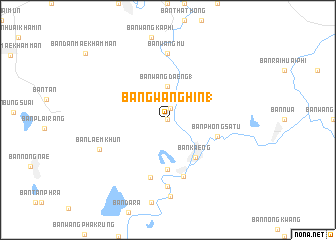
Bang Wang Hin (1) (Uttaradit, Thailand)Bang Wang Hin (1) is a town in the Uttaradit region of Thailand. An overview map of the region around Bang Wang Hin (1) is displayed below.
regional and 3d topo map of Bang Wang Hin (1), Thailand ::
Bang Wang Hin (1) airports ::
The nearest airport is PRH - Phrae, located 73.8 km north of Bang Wang Hin (1).
Other airports nearby include PHS - Phitsanulok (77.6 km south), LPT - Lampang (110.2 km north west), LOE - Loei (170.6 km east), Nearby towns ::
Ban Mai (1) (0.0km north) //
Tron (1.3km north) //
Ban Wang Daeng (1) (3.7km north) //
Ban Kaeng (5.0km south east) //
Ban Hat Song Khwae (5.6km south) //
Ban Phong Satu (5.6km east) //
Ban Den Samrong (6.5km south) //
Ban Tha Sak (6.7km south) //
Ban San (7.4km north) //
Ban Wang Mu (7.4km north) //
Ban Tao Hai (7.4km south) //
Ban Laem Khun (8.0km south west) //
Ban Tao Hai Tai (8.5km south) //
[all distances 'as the bird flies' and approximate]  Places with similar names to Bang Wang Hin (1), Thailand :: Disclaimer :: Information on this page comes without warranty of any kind |
||
|
Where is Bang Wang Hin (1)? Elevation and coordinates ::
Latitude (lat): 17°28'0"N Longitude (lon): 100°7'0"E
Elevation (approx.): 69m (map arrows pan, magnifying glasses zoom) |
||
|
Visiting Bang Wang Hin (1)? Hotel/Accommodation ::
Book a hotel in Bang Wang Hin (1) Travel Guide ::
Buy a travel guide for Thailand rental cars ::
car rental offers GPS waypoint ::
download a GPX waypoint (PoI) of Bang Wang Hin (1) for your GPS receiver
|
||