|
search place name
|
||
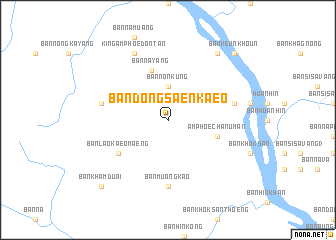
Ban Dong Saen Kaeo (Ubon Ratchathani, Thailand)Ban Dong Saen Kaeo is a town in the Ubon Ratchathani region of Thailand. An overview map of the region around Ban Dong Saen Kaeo is displayed below.
regional and 3d topo map of Ban Dong Saen Kaeo, Thailand ::
Ban Dong Saen Kaeo airports ::
The nearest airport is ZVK - Savannakhet, located 43.6 km north west of Ban Dong Saen Kaeo.
Other airports nearby include SNO - Sakon Nakhon (140.3 km north west), PKZ - Pakse (149.1 km south east), Nearby towns ::
Ban Non Kung (3.7km north) //
Ban Nayang (5.8km north) //
Amphoe Chan Uman (5.7km east) //
Ban Lao Kaeo Maeng (6.5km south west) //
Ban Muang Kao (7.4km south) //
Ban Kham Kaeo (7.4km south) //
Ban Bak (7.4km west) //
Amphoe Chanuman (7.4km east) //
King Amphoe Don Tan (8.2km north west) //
Ban Na Sida (9.1km north east) //
Ban Kham Duai (10.3km south west) //
Ban Veunkhoun (10.3km north east) //
[all distances 'as the bird flies' and approximate] 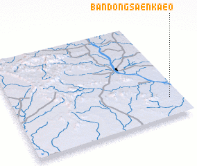 Places with similar names to Ban Dong Saen Kaeo, Thailand ::
// Ban Dong Suang (TH)
// Ban Dong Suang (TH)
// Ban Don Kasang (TH)
// Ban Danxang (LA)
// Ban Danxang (LA)
// Ban Dongsang (LA)
Disclaimer :: Information on this page comes without warranty of any kind |
||
|
Where is Ban Dong Saen Kaeo? Elevation and coordinates ::
Latitude (lat): 16°12'0"N Longitude (lon): 104°56'0"E
Elevation (approx.): 161m (map arrows pan, magnifying glasses zoom) |
||
|
Visiting Ban Dong Saen Kaeo? Hotel/Accommodation ::
Book a hotel in Ban Dong Saen Kaeo Travel Guide ::
Buy a travel guide for Thailand rental cars ::
car rental offers GPS waypoint ::
download a GPX waypoint (PoI) of Ban Dong Saen Kaeo for your GPS receiver
|
||