|
search place name
|
||
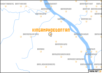
King Amphoe Don Tan (Thailand)King Amphoe Don Tan is a town in Thailand. An overview map of the region around King Amphoe Don Tan is displayed below.
regional and 3d topo map of King Amphoe Don Tan, Thailand ::
King Amphoe Don Tan airports ::
The nearest airport is ZVK - Savannakhet, located 35.4 km north west of King Amphoe Don Tan.
Other airports nearby include SNO - Sakon Nakhon (132.3 km north west), PKZ - Pakse (157.1 km south east), Nearby towns ::
Ban Na Muang (1.9km north) //
Ban Nayang (2.6km south east) //
Ban Non Kung (5.1km south east) //
Don Tan (6.6km north east) //
Ban Bak (6.6km south west) //
Ban Nong Kayang (7.1km west) //
Ban Na Sa-no (8.2km north west) //
Ban Dong Saen Kaeo (8.2km south east) //
[all distances 'as the bird flies' and approximate] 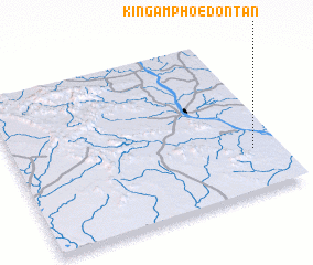 Places with similar names to King Amphoe Don Tan, Thailand :: Disclaimer :: Information on this page comes without warranty of any kind |
||
|
Where is King Amphoe Don Tan? Elevation and coordinates ::
Latitude (lat): 16°16'0"N Longitude (lon): 104°54'0"E
Elevation (approx.): 172m (map arrows pan, magnifying glasses zoom) |
||
|
Visiting King Amphoe Don Tan? Hotel/Accommodation ::
Book a hotel in King Amphoe Don Tan Travel Guide ::
Buy a travel guide for Thailand rental cars ::
car rental offers GPS waypoint ::
download a GPX waypoint (PoI) of King Amphoe Don Tan for your GPS receiver
|
||