|
search place name
|
||
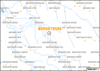
Ban Hat A Sa (1) (Chai Nat, Thailand)Ban Hat A Sa (1) is a town in the Chai Nat region of Thailand. An overview map of the region around Ban Hat A Sa (1) is displayed below.
regional and 3d topo map of Ban Hat A Sa (1), Thailand ::
Ban Hat A Sa (1) airports ::
The nearest airport is BKK - Bangkok Intl, located 140.0 km south of Ban Hat A Sa (1).
Other airports nearby include PHS - Phitsanulok (182.5 km north), NAK - Nakhon Ratchasima Khorat (196.1 km east), Nearby towns ::
Amphoe Sanphaya (1.9km south) //
Sanphaya (1.8km west) //
Ban Sapphaya (1) (3.7km south) //
Ban Pho Nang Dam (2) (4.1km south east) //
Ban Na Phrai (4.0km north east) //
Ban Khao Nom Kho (1) (4.0km north east) //
Ban Oi Noi (2) (5.2km north west) //
Ban Phong Dam Tok (5.8km south) //
Ban O1 Noi (1) (6.5km north west) //
Ban Chang Dao (6.5km north east) //
Ban Taluk (1) (7.7km north west) //
Ban Huai Krot (1) (7.7km south west) //
Ban Chong Khae (8.1km north east) //
Ban Bang Pun (9.2km south east) //
Ban Huai Krot Tai (9.1km south west) //
[all distances 'as the bird flies' and approximate] 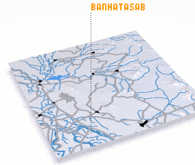 Places with similar names to Ban Hat A Sa (1), Thailand ::
// Ban Hat Sai Bua (TH)
Disclaimer :: Information on this page comes without warranty of any kind |
||
|
Where is Ban Hat A Sa (1)? Elevation and coordinates ::
Latitude (lat): 15°8'0"N Longitude (lon): 100°16'0"E
Elevation (approx.): 14m (map arrows pan, magnifying glasses zoom) |
||
|
Visiting Ban Hat A Sa (1)? Hotel/Accommodation ::
Book a hotel in Ban Hat A Sa (1) Travel Guide ::
Buy a travel guide for Thailand rental cars ::
car rental offers GPS waypoint ::
download a GPX waypoint (PoI) of Ban Hat A Sa (1) for your GPS receiver
|
||