|
search place name
|
||
Ban Khao Nom Kho (1) (Sing Buri, Thailand)Ban Khao Nom Kho (1) is a town in the Sing Buri region of Thailand. An overview map of the region around Ban Khao Nom Kho (1) is displayed below.
regional and 3d topo map of Ban Khao Nom Kho (1), Thailand ::

Ban Khao Nom Kho (1) airports ::
The nearest airport is BKK - Bangkok Intl, located 140.8 km south of Ban Khao Nom Kho (1).
Other airports nearby include PHS - Phitsanulok (180.7 km north), NAK - Nakhon Ratchasima Khorat (192.7 km east), Nearby towns ::
Ban Na Phrai (0.0km north) //
Ban Chang Dao (2.6km north east) //
Ban Hat A Sa (1) (4.0km south west) //
Ban Chong Khae (4.0km north east) //
Amphoe Sanphaya (5.2km south west) //
Ban Nong I Chao (5.4km east) //
Ban Khao Kaeo (5.7km east) //
Sanphaya (5.7km west) //
Ban Pho Nang Dam (2) (5.8km south) //
Ban Sapphaya (1) (6.6km south west) //
Ban Oi Noi (2) (7.4km west) //
Ban Nong Aek (7.6km north) //
Ban Sarika (1) (7.6km north) //
Ban Tao Dam (7.6km north) //
Ban Phong Dam Tok (7.6km south) //
[all distances 'as the bird flies' and approximate] 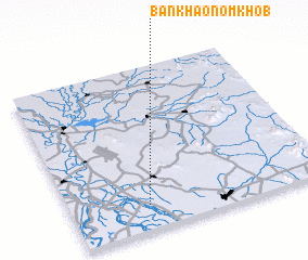 Places with similar names to Ban Khao Nom Kho (1), Thailand :: Disclaimer :: Information on this page comes without warranty of any kind |
||
|
Where is Ban Khao Nom Kho (1)? Elevation and coordinates ::
Latitude (lat): 15°9'0"N Longitude (lon): 100°18'0"E
Elevation (approx.): 14m (map arrows pan, magnifying glasses zoom) |
||
|
Visiting Ban Khao Nom Kho (1)? Hotel/Accommodation ::
Book a hotel in Ban Khao Nom Kho (1) Travel Guide ::
Buy a travel guide for Thailand rental cars ::
car rental offers GPS waypoint ::
download a GPX waypoint (PoI) of Ban Khao Nom Kho (1) for your GPS receiver
|
||