|
search place name
|
||
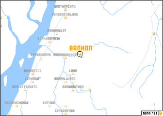
Ban Hon (Ranong, Thailand)Ban Hon is a town in the Ranong region of Thailand. An overview map of the region around Ban Hon is displayed below.
regional and 3d topo map of Ban Hon, Thailand ::
Ban Hon airports ::
The nearest airport is NST - Nakhon Si Thammarat Cha Ian, located 226.0 km south east of Ban Hon.
Nearby towns ::
Ban Bang Kaeo (2.6km north west) //
Ban Bang Kaeo Noi (2.6km north west) //
Ban Phama Kham (3.6km west) //
Laun (4.1km south west) //
Ban Bang Kaen Chan (4.1km south west) //
Ban Na Yao (5.9km south) //
Ban Bang Kae (5.9km south) //
Ban Phlu Kha (2) (6.7km south west) //
Ban Wang Lum (7.4km south) //
Ban Bang Sang Tong (7.4km south) //
Ban Wang Yuan (7.6km south) //
Ban Pak Phlaek (7.6km south) //
Ban Bang Lat (7.8km north west) //
Ban Khao Fachi (8.2km north west) //
[all distances 'as the bird flies' and approximate]  Places with similar names to Ban Hon, Thailand ::
Disclaimer :: Information on this page comes without warranty of any kind |
||
|
Where is Ban Hon? Elevation and coordinates ::
Latitude (lat): 10°9'0"N Longitude (lon): 98°47'0"E
Elevation (approx.): 41m (map arrows pan, magnifying glasses zoom) |
||
|
Visiting Ban Hon? Hotel/Accommodation ::
Book a hotel in Ban Hon Travel Guide ::
Buy a travel guide for Thailand rental cars ::
car rental offers GPS waypoint ::
download a GPX waypoint (PoI) of Ban Hon for your GPS receiver
|
||