|
search place name
|
||
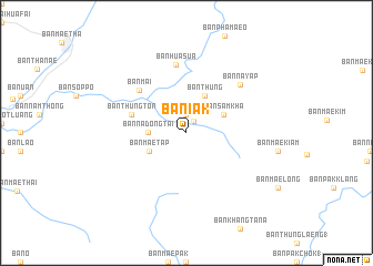
Ban Iak (Lampang, Thailand)Ban Iak is a town in the Lampang region of Thailand. An overview map of the region around Ban Iak is displayed below.
regional and 3d topo map of Ban Iak, Thailand ::
Ban Iak airports ::
The nearest airport is LPT - Lampang, located 25.6 km north west of Ban Iak.
Other airports nearby include PRH - Phrae (52.8 km east), PHS - Phitsanulok (159.6 km south east), Nearby towns ::
Ban Don Fai (1.4km north east) //
Ban Na Bong (1.9km north) //
Ban Na Dong Tai (3.7km west) //
Ban Thung (4.1km north east) //
Ban Sam Kha (4.0km north east) //
Ban Mae Tap (4.0km south west) //
Ban Thung Ton (5.6km west) //
Ban Na Du (5.6km west) //
Ban Mai (6.2km north west) //
Ban Hua Sua (6.9km north) //
Ban Na Yap (7.1km north east) //
[all distances 'as the bird flies' and approximate] 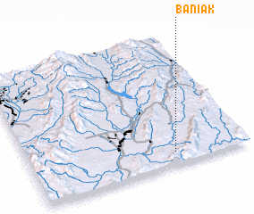 Places with similar names to Ban Iak, Thailand ::
Disclaimer :: Information on this page comes without warranty of any kind |
||
|
Where is Ban Iak? Elevation and coordinates ::
Latitude (lat): 18°6'0"N Longitude (lon): 99°40'0"E
Elevation (approx.): 342m (map arrows pan, magnifying glasses zoom) |
||
|
Visiting Ban Iak? Hotel/Accommodation ::
Book a hotel in Ban Iak Travel Guide ::
Buy a travel guide for Thailand rental cars ::
car rental offers GPS waypoint ::
download a GPX waypoint (PoI) of Ban Iak for your GPS receiver
|
||