|
search place name
|
||
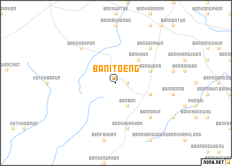
Ban I Toeng (Ubon Ratchathani, Thailand)Ban I Toeng is a town in the Ubon Ratchathani region of Thailand. An overview map of the region around Ban I Toeng is displayed below.
regional and 3d topo map of Ban I Toeng, Thailand ::
Ban I Toeng airports ::
The nearest airport is ZVK - Savannakhet, located 86.2 km north west of Ban I Toeng.
Other airports nearby include PKZ - Pakse (107.0 km south east), SNO - Sakon Nakhon (182.6 km north west), Nearby towns ::
Ban Na Wa (1.9km north) //
Ban Yang Khrua (1.8km east) //
Ban Bak (4.1km south east) //
Ban Khum (5.1km north east) //
Ban Hua Na (5.7km east) //
Ban Huai Yang Noi (5.7km east) //
Ban Khum Kham (7.6km south) //
Ban Don Daeng (7.7km south east) //
Ban Na Hin (7.7km south east) //
Ban Kham Pom (7.7km north west) //
Ban Na Kham (7.7km north east) //
Ban Don Yen Nua (7.7km north west) //
Ban Sai Phun (7.7km north east) //
Ban Kong Phon (7.7km north east) //
[all distances 'as the bird flies' and approximate]  Places with similar names to Ban I Toeng, Thailand ::
Disclaimer :: Information on this page comes without warranty of any kind |
||
|
Where is Ban I Toeng? Elevation and coordinates ::
Latitude (lat): 15°52'0"N Longitude (lon): 105°8'0"E
Elevation (approx.): 171m (map arrows pan, magnifying glasses zoom) |
||
|
Visiting Ban I Toeng? Hotel/Accommodation ::
Book a hotel in Ban I Toeng Travel Guide ::
Buy a travel guide for Thailand rental cars ::
car rental offers GPS waypoint ::
download a GPX waypoint (PoI) of Ban I Toeng for your GPS receiver
|
||