|
search place name
|
||
Ban Yang Khrua (Ubon Ratchathani, Thailand)Ban Yang Khrua is a town in the Ubon Ratchathani region of Thailand. An overview map of the region around Ban Yang Khrua is displayed below.
regional and 3d topo map of Ban Yang Khrua, Thailand ::

Ban Yang Khrua airports ::
The nearest airport is ZVK - Savannakhet, located 87.0 km north west of Ban Yang Khrua.
Other airports nearby include PKZ - Pakse (105.8 km south east), SNO - Sakon Nakhon (183.7 km north west), Nearby towns ::
Ban I Toeng (1.8km west) //
Ban Na Wa (2.6km north west) //
Ban Bak (3.7km south) //
Ban Hua Na (4.0km north east) //
Ban Khum (4.1km north east) //
Ban Huai Yang Noi (4.0km south east) //
Ban Don Daeng (6.6km south east) //
Ban Na Hin (6.6km south east) //
Ban Kong Phon (6.6km north east) //
Ban Na Kham (6.6km north east) //
Ban Sai Phun (6.6km north east) //
Ban Khum Kham (7.4km south) //
Ban Don Saen Phan (7.4km east) //
Ban Non Na (7.4km east) //
Ban Don Yen (9.0km south east) //
Ban Kham Pom (9.0km north west) //
Ban Don Yen Nua (9.0km north west) //
[all distances 'as the bird flies' and approximate] 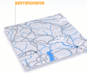 Places with similar names to Ban Yang Khrua, Thailand ::
// Ban Yang Khrua (TH)
// Ban Yang Khrua (TH)
Disclaimer :: Information on this page comes without warranty of any kind |
||
|
Where is Ban Yang Khrua? Elevation and coordinates ::
Latitude (lat): 15°52'0"N Longitude (lon): 105°9'0"E
Elevation (approx.): 172m (map arrows pan, magnifying glasses zoom) |
||
|
Visiting Ban Yang Khrua? Hotel/Accommodation ::
Book a hotel in Ban Yang Khrua Travel Guide ::
Buy a travel guide for Thailand rental cars ::
car rental offers GPS waypoint ::
download a GPX waypoint (PoI) of Ban Yang Khrua for your GPS receiver
|
||