|
search place name
|
||
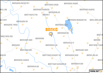
Ban Ko (Ubon Ratchathani, Thailand)Ban Ko is a town in the Ubon Ratchathani region of Thailand. An overview map of the region around Ban Ko is displayed below.
regional and 3d topo map of Ban Ko, Thailand ::
Ban Ko airports ::
The nearest airport is PKZ - Pakse, located 112.3 km east of Ban Ko.
Other airports nearby include ZVK - Savannakhet (131.1 km north), SNO - Sakon Nakhon (213.3 km north), REP - Siem-reap Siem Reap (240.1 km south west), Nearby towns ::
Ban Bok (3.7km north east) //
Ban Nong Lai (4.3km south) //
Ban Sawang (4.2km east) //
Ban Pa Ao (4.4km south west) //
Ban Nong Tae (4.9km north east) //
Ban Pet (7.1km north) //
Ban Nong Manao (7.0km south east) //
Ban Samran (7.1km east) //
Ban Khilek (7.1km south east) //
Ban Sombun (7.8km north) //
Ban Thung Khun Yai (8.0km south) //
Ban Nong Chang (8.0km south west) //
Ban Na Di (7.9km north east) //
Ban Yang Sak Krapho Lum (8.8km north east) //
Ban Phon Phaeng (9.4km north) //
Ban Nong Wa (9.3km south east) //
Ban Thung Tai (9.8km north west) //
Ban Huai Khum (10.8km south east) //
[all distances 'as the bird flies' and approximate] 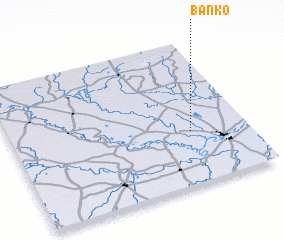 Places with similar names to Ban Ko, Thailand ::
Disclaimer :: Information on this page comes without warranty of any kind |
||
|
Where is Ban Ko? Elevation and coordinates ::
Latitude (lat): 15°22'18"N Longitude (lon): 104°45'55"E
Elevation (approx.): 134m (map arrows pan, magnifying glasses zoom) |
||
|
Visiting Ban Ko? Hotel/Accommodation ::
Book a hotel in Ban Ko Travel Guide ::
Buy a travel guide for Thailand rental cars ::
car rental offers GPS waypoint ::
download a GPX waypoint (PoI) of Ban Ko for your GPS receiver
|
||