|
search place name
|
||
Ban Kui Cha Tho (Kanchanaburi, Thailand)Ban Kui Cha Tho is a town in the Kanchanaburi region of Thailand. An overview map of the region around Ban Kui Cha Tho is displayed below.
regional and 3d topo map of Ban Kui Cha Tho, Thailand ::

Ban Kui Cha Tho airports ::
The nearest airport is PHS - Phitsanulok, located 277.9 km north east of Ban Kui Cha Tho.
Nearby towns ::
Ban Cha Deng Cheng (0.0km north) //
Ban Chi Deng Cheng (1.9km south) //
Ban Nong Lu (3.7km north) //
Ban Nong Kai (3.7km north) //
Ban Rong Ta Kong (5.6km north) //
Ban Nong Tako (5.6km north) //
Ban Pang (5.7km west) //
Ban Pratu Muang (7.6km north) //
Ban Ku Phadu (7.6km north) //
Ban Lawa (8.1km north east) //
Ban Wang Kalang (9.1km north east) //
Ban Ni The (10.3km north east) //
Sangkhla Buri (10.3km north east) //
[all distances 'as the bird flies' and approximate] 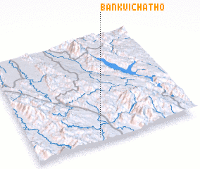 Places with similar names to Ban Kui Cha Tho, Thailand :: Disclaimer :: Information on this page comes without warranty of any kind |
||
|
Where is Ban Kui Cha Tho? Elevation and coordinates ::
Latitude (lat): 15°3'0"N Longitude (lon): 98°24'0"E
Elevation (approx.): 164m (map arrows pan, magnifying glasses zoom) |
||
|
Visiting Ban Kui Cha Tho? Hotel/Accommodation ::
Book a hotel in Ban Kui Cha Tho Travel Guide ::
Buy a travel guide for Thailand rental cars ::
car rental offers GPS waypoint ::
download a GPX waypoint (PoI) of Ban Kui Cha Tho for your GPS receiver
|
||