|
search place name
|
||
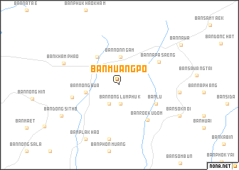
Ban Muang Po (Amnat Charoen, Thailand)Ban Muang Po is a town in the Amnat Charoen region of Thailand. An overview map of the region around Ban Muang Po is displayed below.
regional and 3d topo map of Ban Muang Po, Thailand ::
Ban Muang Po airports ::
The nearest airport is ZVK - Savannakhet, located 81.1 km north of Ban Muang Po.
Other airports nearby include PKZ - Pakse (127.7 km south east), SNO - Sakon Nakhon (169.5 km north west), Nearby towns ::
Ban Nong Lum Phuk (3.0km south) //
Ban Mai (3.4km south west) //
Ban Non Ngam (4.4km north) //
Ban Nong Bua (5.3km west) //
Ban Lao Phruan (5.5km north west) //
Ban Lu (6.3km south east) //
Ban Roek Udom (6.9km south east) //
Ban Na Pa Saeng (7.0km north east) //
Ban Sang Nok Tha (7.4km west) //
Ban Kham (8.7km south) //
Ban Kham Pha-O (9.1km west) //
Ban Pla Khao (10.0km south west) //
[all distances 'as the bird flies' and approximate] 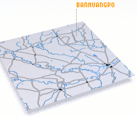 Places with similar names to Ban Muang Po, Thailand ::
// Ban Muang Puai (TH)
// Ban Muangpoua (LA)
Disclaimer :: Information on this page comes without warranty of any kind |
||
|
Where is Ban Muang Po? Elevation and coordinates ::
Latitude (lat): 15°49'37"N Longitude (lon): 104°49'53"E
Elevation (approx.): 153m (map arrows pan, magnifying glasses zoom) |
||
|
Visiting Ban Muang Po? Hotel/Accommodation ::
Book a hotel in Ban Muang Po Travel Guide ::
Buy a travel guide for Thailand rental cars ::
car rental offers GPS waypoint ::
download a GPX waypoint (PoI) of Ban Muang Po for your GPS receiver
|
||